World War 1 maps
Maps of the First World War: the Western Front from the Marne to the Armistice, trench maps, the battles of the Somme, Verdun and Ypres, Gallipoli, the Eastern Front, and the American Expeditionary Forces in 1918.
Why they are free to use: Published before 1931, or US Army maps: public domain in the US. Each map's page shows its own licence basis and a credit line.
The Western Front
Search “map of the Western Front in World War I” for more, or ask Claude for it

Collier's 1921 World War - line on western front at end of war
1921 · Wikimedia Commons

Strategical record map of the western front 1914-1918
1914 · Wikimedia Commons

Map of The Western Front in 1917.
1919 · Wikimedia Commons

Western Front battle lines - March to Nov. 1918
1922 · Wikimedia Commons

Northern part of Western front 1915-16
1915 · Wikimedia Commons

The allies' gains on the western front 1914-1917
1914 · Wikimedia Commons

Western front 1915-16
1915 · Wikimedia Commons

Tasker Howard Bliss collection of World War I maps and related materials.
1916 · Library of Congress
Trench maps
Search “trench map of the Western Front” for more, or ask Claude for it
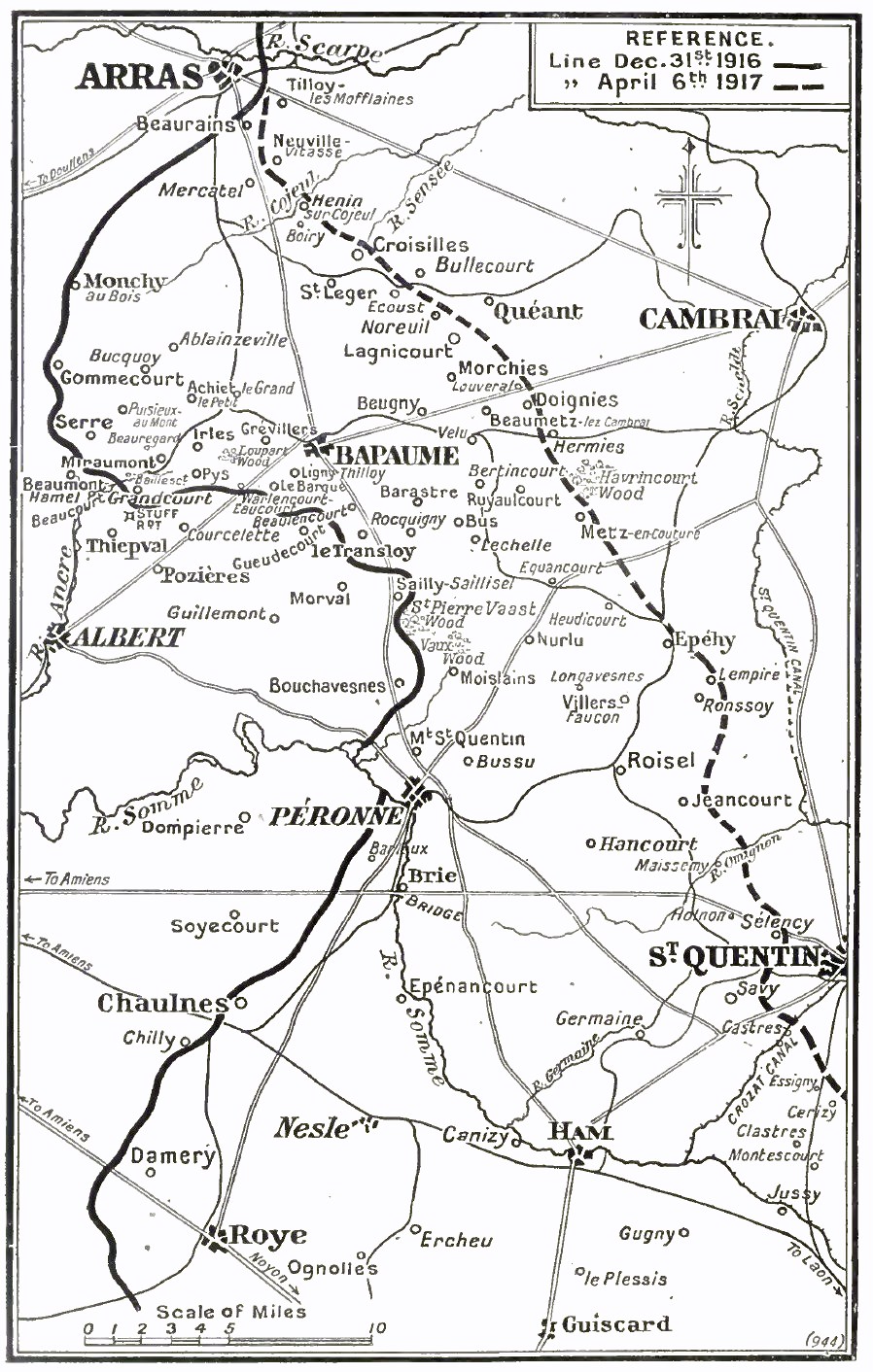
Operation Alberich, March, 1917
c. 1921 · Wikimedia Commons

Maps of the Western Front, 1914 - 1918 Q69706
1914 · Wikimedia Commons

Map showing villages south of the Somme west of Peronne, 1916
1916 · Wikimedia Commons

Battle of the Somme 1916 map
1916 · Wikimedia Commons

French front line, Verdun, 20 August 1917
1917 · Wikimedia Commons

Hand-drawn bird's eye view of the Western Front of World War I between Arras and Soisson
c. 1917 · Wikimedia Commons

Hand-drawn map of the Western Front of World War I between Lille and Peronne
c. 1917 · Wikimedia Commons

Vimy-Sheet36c SW3 Edition 8a 10-02-17
February 10, 1917 · Wikimedia Commons
The American Expeditionary Forces
Search “map of American army operations in France 1918 Meuse-Argonne St. Mihiel” for more, or ask Claude for it

Collier's 1921 World War - American drive at St. Mihiel
1921 · Wikimedia Commons

Map to illustrate the offensive of the St. Mihiel salient.
1918 · Library of Congress

Collier's 1921 World War - where American divisions fought 1918
1921 · Wikimedia Commons

Map to illustrate the Meuse-Argonne Offensive - first, second, and last phases.
1918 · Library of Congress

Meuse-Argonne offensive, map showing daily position of front line - Map Room G-3, G.H.Q., May 24, 1919.
1918 · Library of Congress

The St. Mihiel offensive.
1918 · Library of Congress

Collier's 1921 World War - Meuse-Argonne offensive
1921 · Wikimedia Commons

Collier's 1921 World War - Franco-American offensive
1921 · Wikimedia Commons
The Eastern Front and the Balkans
Search “map of the Eastern Front and Balkan front in World War I” for more, or ask Claude for it

Eastern front October 1, 1915
1915 · Wikimedia Commons

Map of the Eastern Front in the time of Kerensky Offensive in summer of 1917.
1917 · Wikimedia Commons

Hand-drawn bird's eye view map of the Eastern Front of World War I
c. 1917 · Wikimedia Commons

Eastern Front 1916-8
1916 · Wikimedia Commons

Hand-drawn map of the Eastern Front of World War I between Belarus and Romania, showing the front in June, July, August, and September 1916
c. 1917 · Wikimedia Commons

09-Übersichtskarte für den europäischen Kriegsschauplatz
1918 · Wikimedia Commons

Battle for Galicia
1914 · Wikimedia Commons

Map of Central Europe showing the principal theatre of war
1914 · Wikimedia Commons
Gallipoli and the Middle East
Search “map of Gallipoli and the Dardanelles campaign 1915” for more, or ask Claude for it

Map of Gallipoli scale 1-40000 War Office map 683 c 1915
1915 · Wikimedia Commons

Battle of Gallipoli, February–April 1915
1915 · Wikimedia Commons

Attaque des Dardanelles plan general publié en 1915
1915 · Wikimedia Commons

The "Farmer & Settler" map of Gallipoli War area - 1915
1915 · Wikimedia Commons

Collier's 1921 World War - War zone at the Dardanelles
1921 · Wikimedia Commons

Cloth map of the Gallipoli campaign
1915 · Wikimedia Commons

Ca. 1915 map of Gallipoli, Turkey in Asia
c. 1915 · Wikimedia Commons

Orographical map of the Dardanelles reduced from captured Turkish maps
1915 · Wikimedia Commons
Need photographs too? See World War 1 photos on Find Any Photo, our search of public-domain archive photographs.
Need maps for a video, lesson or book?
Add Find Any Map to Claude and ask for the maps you need, part by part. Claude searches this index, shows you the matches with their licences and writes the credit lines.
Add to Claude for free