Old maps
Old maps from the Library of Congress and other public archives, every one checked as public domain: world maps and atlases from the age of exploration, city plans, bird's-eye views of American towns, sea charts and county atlases.
Why they are free to use: Most were published more than a century ago, so their copyright has expired. Each map's page shows its own licence basis and a credit line.
World maps
Search “old world map” for more, or ask Claude for it

Orbis terrarum cognitus veteribus Graecis et Latinis.
1709 · New York Public Library

Map of the ancient Eastern hemisphere, 1719
1683 · Wikimedia Commons
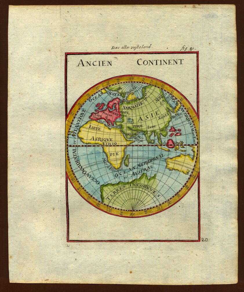
Map of the ancient continents, 1719
1719 · Wikimedia Commons

Map of the Eastern hemisphere, 1683
1683 · Wikimedia Commons

Large-scale-old-map-of-the-world-1702
1702 · Wikimedia Commons

World Chronicle world map 2
1493 · Wikimedia Commons

World Chronicle world map
1493 · Wikimedia Commons

The Yale world map of "Henricus Martellus Germanus" (Heinrich Hammer), probably from Florence 1490-92. It is the most detailed "Dragon Tail" map by Martellus. It is the only one with a coordinate grid
1490 · Wikimedia Commons
City plans
Search “old plan of a city with streets and buildings” for more, or ask Claude for it

Plat of unidentified city.
1810 · Library of Congress

Plan showing the boundaries of the great conflagration of New Orleans on the 21st of March 1788.
1900 · Library of Congress

Map of the old portion of the city surrounding the plaza, showing the Old Plaza Church, public square, the first gas plant and adobe buildings, Los Angeles City
March 12, 1873 · Library of Congress

Plan of village of Newtown (Elmhurst) showing places of historical interest
1908 · Library of Congress

A plan of the city of Philadelphia.
1777 · Library of Congress

Plan of the city of Panama
1850 · Library of Congress

Plan of New Orleans.
1863 · New York Public Library

Scale ca. 1:4,800. Manuscript, pen-and-ink. Unfinished plan. Watermark: J. Whatman and a horn within a shield with JW below Oriented with north toward the lower right. On verso: My M. Blimes. Vault. A
1780 · Library of Congress
Bird's-eye views
Search “bird's-eye view of a city” for more, or ask Claude for it

View of the city of Providence as seen from the dome of the new State House.
1896 · Library of Congress

Schenectady, N.Y.
1882 · Library of Congress

"Bird's Eye View of the City of Knoxville, Knox County, Tennessee, 1871," a map of Knoxville, Tennessee, USA, published in 1871.
1871 · Library of Congress

Gezicht op een stad in vogelvluchtperspectief met een straat die bergopwaarts gaat Kleine architecturale perspectief gezichten (serietitel) Variae Architecturae formae (serietitel), RP-P-1964-1628
1562–1601 · Wikimedia Commons

View of Washington City.
1871 · Library of Congress

Aerial view of Bologna showing the main buildings and streets Engraving
1581–1613 · Wikimedia Commons

Panoramic view of the wholesale and office district of St. Louis.
1904 · Library of Congress

Binghamton, NY
1882 · Library of Congress
Sea charts
Search “old nautical chart of a coast with soundings” for more, or ask Claude for it

Map of coast from southern Florida to central New Jersey.
1780 · Library of Congress

(Coast of New Hampshire and Massachusetts from Great Boars Head to Marblehead Harbor.
1781 · Library of Congress

Este plano manifiesta la configuración del bajo llamado el Cascabel ignorado hasta a Ora de los Practicos de esta costa su bendadera cituación la qe. se encontro ser por latitud septentrional de 11
1790 · Library of Congress

From Mr. Bothfeld's survey of 1875 for U.S. Eng'rs (details omitted) - (waters southwest of Lovell Island, Boston, Massachusetts).
1878 · Library of Congress

Plano de una bahía de la costa del norueste de América en latitd. 50⁰38ʹ nte. longd. 231⁰25ʹ est m. d. G.
1780 · Library of Congress

Buzzards Bay and shoals of Nantucket.
1778 · Library of Congress

Navegación de las corvetas de S.M. Descuvierta y Atrevida sovre la costa Patagonica, año d. 1789
1789 · Library of Congress

Map showing coast of Veracruz State, Mexico, between Tampico and Antón Lizardo.
1760 · Library of Congress
County atlases
Search “county atlas map showing land owners” for more, or ask Claude for it

Illustrated atlas of Lake County, Illinois - containing maps of every township in the county, with village and city plats - also maps of Michigan. Texas, and Washington Territory - compiled
1885 · 40 sheets

Standard atlas of Washtenaw County, Michigan - including a plat book of the villages, cities and townships of the county, map of the state, United States and world, farmers directory, reference
1895 · Library of Congress

Atlas of Genesee County, Michigan - containing maps of every township in the county, with village and city plats. - from actual surveys and official records
1889 · 40 sheets

Historical hand-atlas, illustrated, containing large scale copper plate maps of each state and territory of the United States, and the provinces of Canada, together with a complete reference map
1881 · Library of Congress

Illustrated atlas of Shiawassee County, Michigan - compiled and published from recent surveys, official records and personal examinations - including brief biographical sketches of enterprising
1895 · 40 sheets

Map of Carver County, Minnesota - drawn from actual surveys and the county records.
1880 · Library of Congress

Atlas of Marshall Co. and the state of Illinois - to which is added an atlas of the United States, maps of the hemispheres etc. etc. etc.
1870 · 39 sheets

Atlas of Clinton County, Michigan
1873 · 28 sheets
Need maps for a video, lesson or book?
Add Find Any Map to Claude and ask for the maps you need, part by part. Claude searches this index, shows you the matches with their licences and writes the credit lines.
Add to Claude for free