
1800 Wilkinson Map of the 4 Eastern Churches rectified
Map of the 4 Eastern Churches in the Pentarchy, circa 500CE
- Date
- 1800
- Mapmaker / publisher
- 1800_Wilkinson_Map_of_the_4_Eastern_Churches.jpg: Robert Wilkinson (mapmaker). *derivative work: MichaelBueker ( talk )
- Place
- history of Christianity
- Archive
- Wikimedia Commons
- Type
- map
- Sheets
- 2
- Original size
- 415 × 667 pixels
Public domain
Reason: its maker died long enough ago that the copyright has expired.
This status rests on the map's publication history, as researched by Wikimedia Commons. Check it before commercial use.
Read from: Commons licence category: PD Old; no CC BY, CC BY-SA, GFDL or deletion tag on the file page.
Credit line
"1800 Wilkinson Map of the 4 Eastern Churches rectified" (1800). 1800_Wilkinson_Map_of_the_4_Eastern_Churches.jpg: Robert Wilkinson (mapmaker). *derivative work: MichaelBueker ( talk ), via Wikimedia Commons. Public domain. https://commons.wikimedia.org/wiki/File:1800_Wilkinson_Map_of_the_4_Eastern_Churches_rectified_(cropped).jpgNeed maps for a whole project? Add Find Any Map to Claude and ask for this one by its id: 239253.
All 2 sheets
Each sheet links to its file at the archive; the image link is the full-size scan.


More like this

1800 Wilkinson Map of the 4 Eastern Churches
1822 · Wikimedia Commons

C. 750 Eastern Patriarchates
1888–1897 · Wikimedia Commons
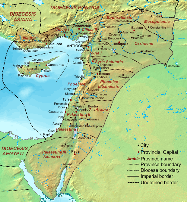
Dioecesis Orientis 400 AD
September 19, 2007 · Wikimedia Commons

Dioecesis Aegypti 400 AD
September 22, 2007 · Wikimedia Commons

A New Map of the Eastern Parts of Asia Minor
c. 1712 · Wikimedia Commons

Kunyu Wanguo Quantu (坤輿萬國全圖) Middle East
1604 · Wikimedia Commons

Ancient Eastern Empires (Atlas of European history, 1909)
January 19, 2012 · Wikimedia Commons

C. 1140 Asia Minor and Crusader States
c. 1911 · Wikimedia Commons