

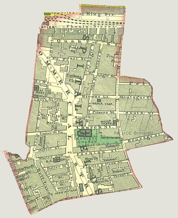
Whitechapel Spitalfields 7 murders
- Date
- November 29, 2009
- Mapmaker / publisher
- User:ΛΦΠ
- Archive
- Wikimedia Commons
- Type
- map
- Original size
- 3,315 × 2,020 pixels
Public domain
Reason: public domain: user.
This status rests on the map's publication history, as researched by Wikimedia Commons. Check it before commercial use.
Read from: Commons licence category: PD-user; no CC BY, CC BY-SA, GFDL or deletion tag on the file page.
Credit line
"Whitechapel Spitalfields 7 murders" (November 29, 2009). User:ΛΦΠ, via Wikimedia Commons. Public domain. https://commons.wikimedia.org/wiki/File:Whitechapel_Spitalfields_7_murders.PNGNeed maps for a whole project? Add Find Any Map to Claude and ask for this one by its id: 245422.
More like this

Whitechapel Flower and Dean St
Wikimedia Commons

Spittle Fields and places adjacent taken from ye last survey with corrections
1720 · BM Heal,Topography.229

Isle of dogs 1899
1899 · Wikimedia Commons

A map of the Parish of St Mary White Chappel
1720 · BM Heal,Topography.231

1893 ordnance survey map of the Cumberland Market area of London.
1890s · Wikimedia Commons

1745 Roque Map
1745 · Wikimedia Commons

The Fenian Barracks
1898 · Wikimedia Commons
Spitalfields Parish map 1885
1885 · Wikimedia Commons