

Upper Canada and the Iroquois Confederacy
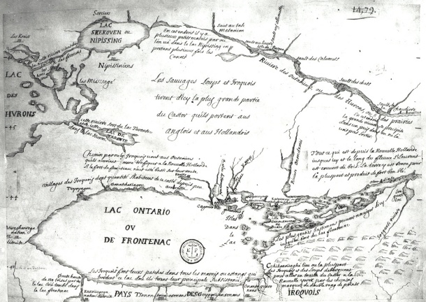
Map of Lac de Frontenac (Lake Ontario), showing Teiaiagon and Lac Taronto, and the land occupied by the Mississaugas and the Algonquin.
- Date
- 1860
- Place
- Canada
- Archive
- Wikimedia Commons
- Type
- map
- Original size
- 1,050 × 1,531 pixels
Public domain
Reason: public domain: Canada.
This status rests on the map's publication history, as researched by Wikimedia Commons. Check it before commercial use.
Read from: Commons licence category: PD Canada; no CC BY, CC BY-SA, GFDL or deletion tag on the file page.
Credit line
"Upper Canada and the Iroquois Confederacy" (1860). Wikimedia Commons. Public domain. https://commons.wikimedia.org/wiki/File:Upper_Canada_and_the_Iroquois_Confederacy.jpgNeed maps for a whole project? Add Find Any Map to Claude and ask for this one by its id: 295472.
More like this

Darlington map of lake ontario 1680
1680 · Wikimedia Commons

Description du pais des Hurons.
1651 · Library of Congress
Early map of Lake Ontario
Wikimedia Commons

Carte du Lac Ontario et de la Riviere jusques au dela de L Isle de Montreal celle de Niagara et partie du Lac Erie
October 11, 1726 · Wikimedia Commons

Darlinton map of lake huron 1680
1680 · Wikimedia Commons

Map of Huron Country, 1631–51
1639–1651 · Wikimedia Commons

Sketch Map of Upper Canada showing the routes Lt Gov Simcoe took on journeys between March 1793 and September 1795
1795 · Wikimedia Commons

1744 bellin map Carte des lacs du Canada
1744 · Wikimedia Commons