

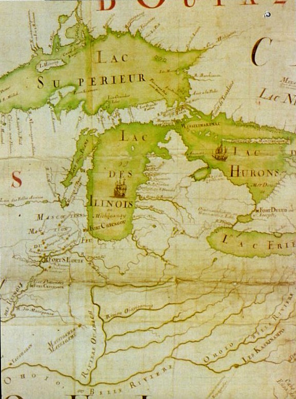
Darlinton map of lake huron 1680
This is a section of a map that is part of the Darlington map collection housed in the Archives Service Center, University Library System, University of Pittsburgh, Pittsburgh, PA US The original map from which this portion was taken can be found here.
- Date
- 1680
- Mapmaker / publisher
- unknown mapmaker
- Place
- Lake Huron
- Archive
- Wikimedia Commons
- Type
- map
- Original size
- 683 × 540 pixels
Public domainsafest
Reason: its US copyright has expired (published before 1931).
Read from: Commons licence category: PD US expired; no CC BY, CC BY-SA, GFDL or deletion tag on the file page.
Credit line
"Darlinton map of lake huron 1680" (1680). unknown mapmaker, via Wikimedia Commons. Public domain. https://commons.wikimedia.org/wiki/File:Darlinton_map_of_lake_huron_1680.pngNeed maps for a whole project? Add Find Any Map to Claude and ask for this one by its id: 295563.
More like this

Darlington map of lake ontario 1680
1680 · Wikimedia Commons
Amerique Septentrionale JBF 1688-detail
1688 · Wikimedia Commons

Description du pais des Hurons.
1651 · Library of Congress

Darlington map of the mississippi river 1680
1680 · Wikimedia Commons

Tiré de la relation des Hurons de 1647 et 48, par Guillaume Delisle
1703 · Wikimedia Commons

Lac Teiocha-Rontiong, dit communement Lac Érié
1675 · Wikimedia Commons

1744 bellin map Carte des lacs du Canada
1744 · Wikimedia Commons

Partie occidentale de la Nouvelle France ou Canada
1745 · New York Public Library