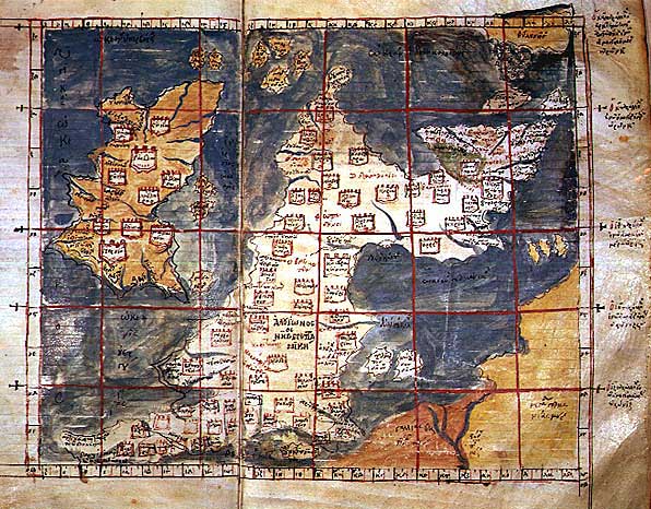

Ptolemaic Britain
The "1st Map of Europe": A Greek-language map of Hibernia (Ireland) and Albion (Great Britain) derived from Ptolemy's Geography, probably in the early 14th century at Constantinople (Istanbul), held by the Vatopedi Monastery on Mount Athos prior to its theft and purchase by the British Museum. It reflects Ptolemy's mistaken placement of Scotland at a right angle to the rest of Britain, apparently derived from his reliance on seafarer's logs. False color version.
- Mapmaker / publisher
- Anonymous (likely a monk or scholar of Constantinople, sometimes associated with Maximus Planudes) Based upon the Geography of Claudius Ptolemy
- Archive
- Wikimedia Commons
- Type
- map
- Original size
- 596 × 466 pixels
Public domain
Reason: its maker died more than 100 years ago, and a faithful scan of a flat work adds no new copyright.
This status rests on the map's publication history, as researched by Wikimedia Commons. Check it before commercial use.
Read from: Commons licence category: PD-Art (PD-old-100); no CC BY, CC BY-SA, GFDL or deletion tag on the file page.
Credit line
"Ptolemaic Britain". Anonymous (likely a monk or scholar of Constantinople, sometimes associated with Maximus Planudes) Based upon the Geography of Claudius Ptolemy, via Wikimedia Commons. Public domain. https://commons.wikimedia.org/wiki/File:Ptolemaic_Britain.jpgNeed maps for a whole project? Add Find Any Map to Claude and ask for this one by its id: 245869.
More like this

Add 19391 19-20
Wikimedia Commons

Descriptio Prime Tabulae Europae
1450–1475 · Wikimedia Commons

A collection of maps, in Greek, after Ptolemy's Geographia
Ptolemy| date = 1420

Iouernia kai Alouionos Nesoi
Wikimedia Commons

Карта Птолемея
Wikimedia Commons

Iouernia kai Alouionos Nesoi B
Wikimedia Commons

Prima Europe tabula
1486 · Wikimedia Commons

A collection of maps, in Greek, after Ptolemy's Geography
1420 · Europe