

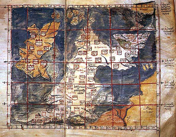
Iouernia kai Alouionos Nesoi B
The left half of the 1st European Map, depicting the British Isles: Ireland (, "Iwernia British Island", i.e. Hibernia) and Great Britain (, "Alwionos British Island", i.e. Albion) from an early 15th-century Greek manuscript copy of Ptolemy's Geography (MS Gr Z 388 =333 f. 53 v.) from the collection at Venice's St Mark's Library (Biblioteca Nazionale Marciano di Venezia).
- Mapmaker / publisher
- Ptolemy
- Archive
- Wikimedia Commons
- Type
- map
- Original size
- 459 × 600 pixels
Public domain
Reason: its maker died more than 100 years ago, and a faithful scan of a flat work adds no new copyright.
This status rests on the map's publication history, as researched by Wikimedia Commons. Check it before commercial use.
Read from: Commons licence category: PD-Art (PD-old-100); no CC BY, CC BY-SA, GFDL or deletion tag on the file page.
Credit line
"Iouernia kai Alouionos Nesoi B". Ptolemy, via Wikimedia Commons. Public domain. https://commons.wikimedia.org/wiki/File:Iouernia_kai_Alouionos_Nesoi_B.jpgNeed maps for a whole project? Add Find Any Map to Claude and ask for this one by its id: 245881.
More like this

Iouernia kai Alouionos Nesoi
Wikimedia Commons

A collection of maps, in Greek, after Ptolemy's Geographia
Ptolemy| date = 1420

Descriptio Prime Tabulae Europae
1450–1475 · Wikimedia Commons

A collection of maps, in Greek, after Ptolemy's Geography
1420 · Europe

Europe Tabula Prima
1426 · Wikimedia Commons
Ptolemaic Britain
Wikimedia Commons

Карта Птолемея
Wikimedia Commons

Ispania Lousitani kai Baitike
Wikimedia Commons