

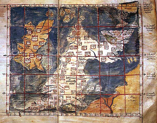
Карта Птолемея
Ptolemy's 1st European Map (Descriptio Primae Tabulae Europae): Albion (Great Britain) and Hibernia (Ireland). Note that the source claims that this is from Berlinghieri's Seven Days of Geography, but that work was in Italian and used Marinus's equirectangular projection rather than Ptolemy's trapezoidal one. The work seems to have been mislabeled at some point, or maps from another Ptolemy added to the Berlinghieri.
- Mapmaker / publisher
- Ptolemy
- Archive
- Wikimedia Commons
- Type
- map
- Original size
- 7,146 × 5,970 pixels
Public domain
Reason: its maker died more than 100 years ago, and a faithful scan of a flat work adds no new copyright.
This status rests on the map's publication history, as researched by Wikimedia Commons. Check it before commercial use.
Read from: Commons licence category: PD-Art (PD-old-100); no CC BY, CC BY-SA, GFDL or deletion tag on the file page.
Credit line
"Карта Птолемея". Ptolemy, via Wikimedia Commons. Public domain. https://commons.wikimedia.org/wiki/File:%D0%9A%D0%B0%D1%80%D1%82%D0%B0_%D0%9F%D1%82%D0%BE%D0%BB%D0%B5%D0%BC%D0%B5%D1%8F.jpgNeed maps for a whole project? Add Find Any Map to Claude and ask for this one by its id: 245874.
More like this

Descriptio Prime Tabulae Europae
1450–1475 · Wikimedia Commons

Iouernia kai Alouionos Nesoi
Wikimedia Commons
Ptolemaic Britain
Wikimedia Commons

Iouernia kai Alouionos Nesoi B
Wikimedia Commons

Prima Europe tabula
1486 · Wikimedia Commons

A collection of maps, in Greek, after Ptolemy's Geographia
Ptolemy| date = 1420

Prima Europe Tabula
1478 · Wikimedia Commons

Tabula Prima dEuropa
1482 · Wikimedia Commons