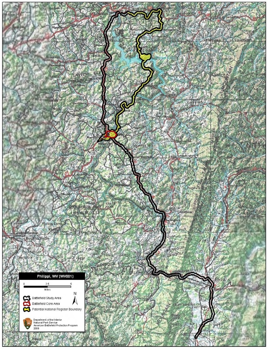

Philippi Battlefield West Virginia
Map of battlefield core and study areas. The Study Area was revised to include the route of the lengthy but calculated Federal advance from Grafton and the route of the Confederate retreat to Beverly.
- Date
- February 2, 2010
- Mapmaker / publisher
- American Battlefield Protection Program
- Archive
- Wikimedia Commons
- Type
- map
- Original size
- 860 × 1,120 pixels
Public domainsafest
Reason: a US government work.
Read from: Commons licence category: PD US Government; no CC BY, CC BY-SA, GFDL or deletion tag on the file page.
Credit line
"Philippi Battlefield West Virginia" (February 2, 2010). American Battlefield Protection Program, via Wikimedia Commons. Public domain. https://commons.wikimedia.org/wiki/File:Philippi_Battlefield_West_Virginia.jpgNeed maps for a whole project? Add Find Any Map to Claude and ask for this one by its id: 1223.
More like this

Rich Mountain Battlefield West Virginia
February 2, 2010 · Wikimedia Commons

Cheat Mountain Battlefield West Virginia
February 2, 2010 · Wikimedia Commons

Greenbrier River Battlefield West Virginia
2010 · Wikimedia Commons

Summit Point Battlefield West Virginia
February 2, 2010 · Wikimedia Commons

Moorefield Battlefield West Virginia
February 2, 2010 · Wikimedia Commons

Harpers Ferry Battlefield West Virginia
February 2, 2010 · Wikimedia Commons

Folck's Mill Battlefield Maryland
January 21, 2010 · Wikimedia Commons

Wyse Fork Battlefield North Carolina
April 14, 2010 · Wikimedia Commons