

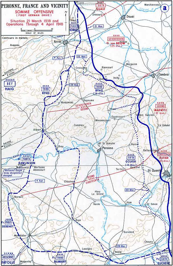
Limit of the German advance during Operation Michael, March–April 1918
Map showing the western limit of the German advance in Operation Michael, from March–April 1918
- Date
- 1922
- Mapmaker / publisher
- The Times staff writers
- Archive
- Wikimedia Commons
- Type
- map
- Original size
- 893 × 1,445 pixels
Public domain
Reason: a US government work.
This status rests on the map's publication history, as researched by Wikimedia Commons. Check it before commercial use.
Read from: Commons licence category: PD US; no CC BY, CC BY-SA, GFDL or deletion tag on the file page.
Credit line
"Limit of the German advance during Operation Michael, March–April 1918" (1922). The Times staff writers, via Wikimedia Commons. Public domain. https://commons.wikimedia.org/wiki/File:Limit_of_the_German_advance_during_Operation_Michael,_March%E2%80%93April_1918.pngNeed maps for a whole project? Add Find Any Map to Claude and ask for this one by its id: 23177.
More like this

Operation Michael 1918 Map SGW Vol VII
c. 1919 · Wikimedia Commons
Map of German Somme offensive 1918
1918 · Wikimedia Commons

German advance, 23-28 March 1918
1918 · Wikimedia Commons

Plan for Michael attack, March 1918
1919 · Wikimedia Commons

1918 michael
1919 · Wikimedia Commons

51st (Highland) Div positions March 1918
1921 · Wikimedia Commons

Collier's 1921 World War - German drives
1921 · Wikimedia Commons

Western Front battle lines - March to Nov. 1918
1922 · Wikimedia Commons