

1918 michael
Map of plan for attack on British salient near Cambrai in 1918. Color added to emphasis part of front that was not to be broken through to attempt to encircle British V Corps.
- Date
- 1919
- Mapmaker / publisher
- Kronprinz Rupprecht von Bayern
- Archive
- Wikimedia Commons
- Type
- map
- Original size
- 682 × 726 pixels
Public domainsafest
Reason: its US copyright has expired (published before 1931).
Read from: Commons licence category: PD US expired; no CC BY, CC BY-SA, GFDL or deletion tag on the file page.
Credit line
"1918 michael" (1919). Kronprinz Rupprecht von Bayern, via Wikimedia Commons. Public domain. https://commons.wikimedia.org/wiki/File:1918_michael.jpgNeed maps for a whole project? Add Find Any Map to Claude and ask for this one by its id: 23126.
More like this

Plan for Michael attack, March 1918
1919 · Wikimedia Commons
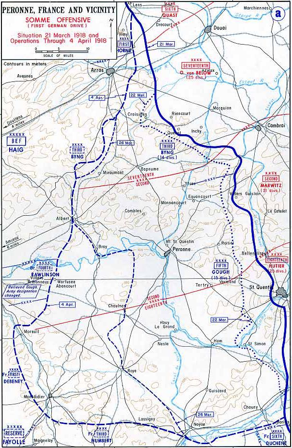
Map of German Somme offensive 1918
1918 · Wikimedia Commons

Limit of the German advance during Operation Michael, March–April 1918
1922 · Wikimedia Commons

Map of German Lys offensive 1918
1918 · Wikimedia Commons

Western front 1918 german
1918 · Wikimedia Commons

Operation Michael 1918
1918 · Wikimedia Commons

Operation Michael 1918 Map SGW Vol VII
c. 1919 · Wikimedia Commons

Mai-Angriff 1918
1918 · Wikimedia Commons