

Important Points in the Wytheville Raid
Map shows the region around Wytheville, Virginia, in 1861 -- close to the time of the Wytheville Raid in 1863. Wytheville, the Austin lead mines, Saltville, and the New Bern/Dublin railroad depot were all key points of interest to the Union Army. Skirmishes occurred in Abb's Valley and Burkes Garden while the Union Brigade was moving toward Wytheville.
- Date
- 1861
- Mapmaker / publisher
- J. H. Colton modified by TwoScarsUp
- Place
- Virginia in the American Civil War
- Archive
- Library of Congress (via Wikimedia Commons)
- Type
- map
- Original size
- 813 × 401 pixels
Public domain
Reason: a US government work.
This status rests on the map's publication history, as researched by Wikimedia Commons. Check it before commercial use.
Read from: Commons licence category: PD US; no CC BY, CC BY-SA, GFDL or deletion tag on the file page.
Credit line
"Important Points in the Wytheville Raid" (1861). J. H. Colton modified by TwoScarsUp. Library of Congress, Geography and Map Division, via Wikimedia Commons. Public domain. https://commons.wikimedia.org/wiki/File:Important_Points_in_the_Wytheville_Raid.pngNeed maps for a whole project? Add Find Any Map to Claude and ask for this one by its id: 610.
More like this

Approach to Wytheville 2 1863
1863 · Library of Congress

Union Approach to Wytheville 1863
1863 · Library of Congress

Wytheville Raid Map
1862 · Library of Congress
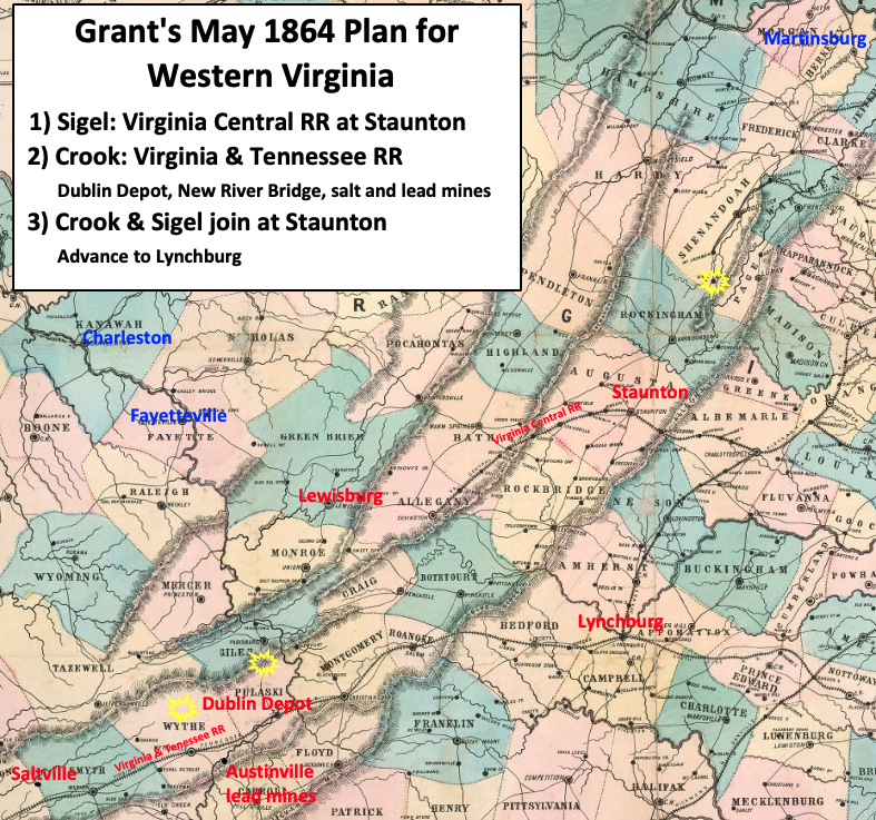
New Union Army leader U.S. Grant's strategy in Virginia was to attack the strongest Confederate Army, Robert E. Lee's Army of Northern Virginia, from multiple fronts. The map shows the plan for wester
1861 · Library of Congress

Virginia 1864
1864 · Library of Congress

Princeton was at the intersection of roads that led to strategic Confederate resources
1862 · Library of Congress

Lightburns Retreat September 1862
1862 · Wikimedia Commons
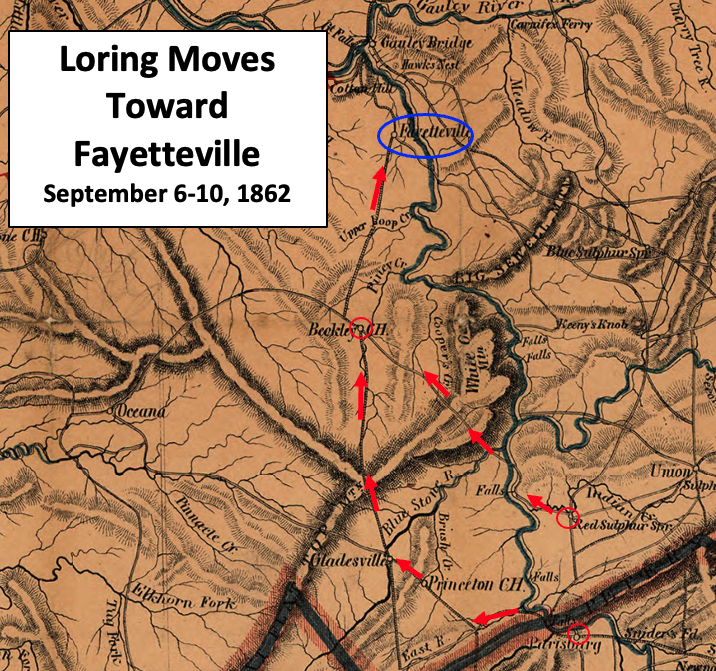
Loring Moves Toward Fayetteville
1864 · Wikimedia Commons