

Virginia 1864
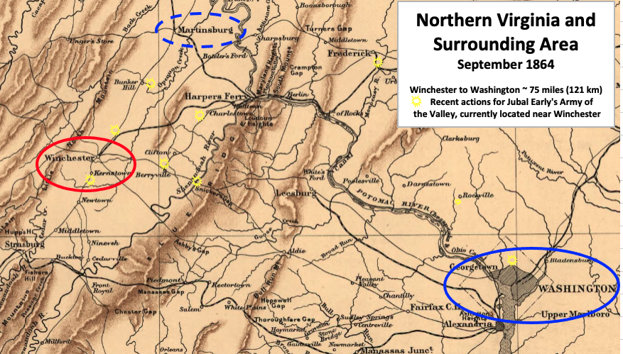
Map shows strategic points in Virginia in the last half of 1864 during the American Civil War
- Date
- 1864
- Mapmaker / publisher
- The author of the main map is Alvin Jewett Johnson (1827-1884). TwoScarsUp made labels and circles, some based on the books "The Shenandoah Valley Campaign of 1864", edited by Gary W. Gallagher (inclu
- Place
- Virginia
- Archive
- Library of Congress (via Wikimedia Commons)
- Type
- map
- Original size
- 1,159 × 706 pixels
Public domainsafest
Reason: its maker died more than 70 years ago.
Read from: Commons licence category: PD-old-70-expired; no CC BY, CC BY-SA, GFDL or deletion tag on the file page.
Credit line
"Virginia 1864" (1864). The author of the main map is Alvin Jewett Johnson (1827-1884). TwoScarsUp made labels and circles, some based on the books "The Shenandoah Valley Campaign of 1864", edited by Gary W. Gallagher (inclu. Library of Congress, Geography and Map Division, via Wikimedia Commons. Public domain. https://commons.wikimedia.org/wiki/File:Virginia_1864.pngNeed maps for a whole project? Add Find Any Map to Claude and ask for this one by its id: 1335.
More like this

Virginia October 1864 Winchester - Mt Jackson
1912 · Library of Congress

U.S. Grant's plan in April 1864 to eliminate Lee's Confederate army in Virginia during the American Civil War
1864 · Library of Congress

Virginia October 1864 big picture V2
1912 · Library of Congress

Virginia October 1864 big picture
1912 · Library of Congress
Northern VA 1864 Early
1912 · Library of Congress

Map showing the location of battle fields of Virginia
1864 · Library of Congress

Hunter's victory at Mount Crawford (October 2, 1864). Scene of the operations in Shenadoah Valley-capture of Staunton (June 6, 1864).
1864 · Library of Congress

Hotchkiss Map of 1864 Valley Campaign
1864 · Wikimedia Commons