

Virginia October 1864 big picture
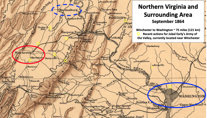
Larger view of the Valley Pike region in Virginia surrounding the area where the Battle of Cedar Creek was fought on October 19, 1864, in the American Civil War. Closeup shows the Cedar Creek - Hupp Hill - Strasburg - Middletown area of Virginia.
- Date
- 1912
- Mapmaker / publisher
- Sifton, Praed & Company, Ltd. with labels and circles added by TwoScarsUp based on the following books: The Guns of Cedar Creek by Thomas A. Lewis, The War in the East from Gettysburg to Appomattox by
- Archive
- Library of Congress (via Wikimedia Commons)
- Type
- map
- Original size
- 919 × 757 pixels
Public domainsafest
Reason: its US copyright has expired (published before 1931).
Read from: Commons licence category: PD US expired; no CC BY, CC BY-SA, GFDL or deletion tag on the file page.
Credit line
"Virginia October 1864 big picture" (1912). Sifton, Praed & Company, Ltd. with labels and circles added by TwoScarsUp based on the following books: The Guns of Cedar Creek by Thomas A. Lewis, The War in the East from Gettysburg to Appomattox by. Library of Congress, Geography and Map Division, via Wikimedia Commons. Public domain. https://commons.wikimedia.org/wiki/File:Virginia_October_1864_big_picture.pngNeed maps for a whole project? Add Find Any Map to Claude and ask for this one by its id: 208.
More like this

Virginia October 1864 Winchester - Mt Jackson
1912 · Library of Congress

Virginia October 1864 big picture V2
1912 · Library of Congress

Battle fields of Fisher's Hill (22 Sept. 1864) and Cedar Creek (19 Oct. 1864), Virginia
1864 · Library of Congress

Strasburg - Front Royal - Winchester
1912 · Library of Congress
Northern VA 1864 Early
1912 · Library of Congress

Virginia 1864
1864 · Library of Congress

Northern VA-DC 1864
1912 · Library of Congress

Orange - Culpepper - Mine Run VA
1912 · Library of Congress