

Lightburns Retreat September 1862
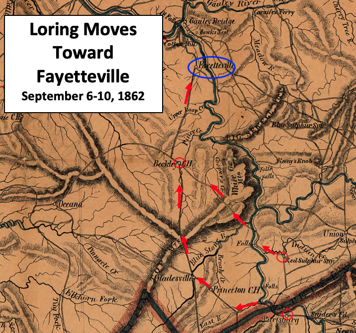
Map shows the Union and Confederate troop movements during September 1862 in the southwest portion of what became West Virginia.
- Date
- 1862
- Mapmaker / publisher
- Jacob Dolson Cox modified by TwoScarsUp
- Place
- West Virginia
- Archive
- Wikimedia Commons
- Type
- map
- Original size
- 585 × 620 pixels
Public domain
Reason: a US government work.
This status rests on the map's publication history, as researched by Wikimedia Commons. Check it before commercial use.
Read from: Commons licence category: PD US; no CC BY, CC BY-SA, GFDL or deletion tag on the file page.
Credit line
"Lightburns Retreat September 1862" (1862). Jacob Dolson Cox modified by TwoScarsUp, via Wikimedia Commons. Public domain. https://commons.wikimedia.org/wiki/File:Lightburns_Retreat_September_1862.JPGNeed maps for a whole project? Add Find Any Map to Claude and ask for this one by its id: 758.
More like this
Loring Moves Toward Fayetteville
1864 · Wikimedia Commons

Union Approach to Wytheville 1863
1863 · Library of Congress

Approach to Wytheville 2 1863
1863 · Library of Congress

Wytheville Raid Map
1862 · Library of Congress

Map of western Virginia
1862 · Library of Congress

Sinking Creek Raid Map 3
1862 · Library of Congress

Important Points in the Wytheville Raid
1861 · Library of Congress

Military reconnaissance in the vicinity of Gauley Bridge, Department of western Virginia, Brig. Genl. W. S. Rosecrans, comd'g., Sept. 11th to Nov. 15, 1861
1879 · Library of Congress