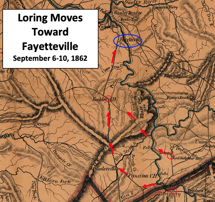

Loring Moves Toward Fayetteville
This map shows the September 6-10, 1862, movement of Confederate troops under the command of Major General William W. Loring in the American Civil War.
- Date
- 1864
- Mapmaker / publisher
- W. L. Nicholson modified by TwoScarsUp
- Archive
- Wikimedia Commons
- Type
- map
- Original size
- 716 × 671 pixels
Public domainsafest
Reason: its maker died more than 70 years ago.
Read from: Commons licence category: PD-old-70-expired; no CC BY, CC BY-SA, GFDL or deletion tag on the file page.
Credit line
"Loring Moves Toward Fayetteville" (1864). W. L. Nicholson modified by TwoScarsUp, via Wikimedia Commons. Public domain. https://commons.wikimedia.org/wiki/File:Loring_Moves_Toward_Fayetteville.pngNeed maps for a whole project? Add Find Any Map to Claude and ask for this one by its id: 951.
More like this

Lightburns Retreat September 1862
1862 · Wikimedia Commons

Union Approach to Wytheville 1863
1863 · Library of Congress

Map of Wyoming, Fayette and Raleigh Counties, West Va.
1862 · Library of Congress

Approach to Wytheville 2 1863
1863 · Library of Congress

Map of western Virginia
1862 · Library of Congress

Map of western Virginia
1862 · Library of Congress

Crook-Averell RR Raid Plan 1864 V2
1861 · Library of Congress

Map of Greenbrier, Summers, Raleigh, Mercer and Monroe Counties, West Va. and Bland, Giles and Craig Counties, Va.
1862 · Library of Congress