

Crook-Averell RR Raid Plan 1864 V2
Union Army May 1863 plan to attack the Virginia & Tennessee Railroad and important salt and lead mines. Text box added by TwoScarsUp. (This version is plainer and less detailed than the previous version.)
- Date
- 1861
- Mapmaker / publisher
- O.N. Snow with modifications by TwoScarsUp
- Archive
- Library of Congress (via Wikimedia Commons)
- Type
- map
- Original size
- 789 × 761 pixels
Public domainsafest
Reason: its US copyright has expired (published before 1931).
Read from: Commons licence category: PD US expired; no CC BY, CC BY-SA, GFDL or deletion tag on the file page.
Credit line
"Crook-Averell RR Raid Plan 1864 V2" (1861). O.N. Snow with modifications by TwoScarsUp. Library of Congress, Geography and Map Division, via Wikimedia Commons. Public domain. https://commons.wikimedia.org/wiki/File:Crook-Averell_RR_Raid_Plan_1864_V2.pngNeed maps for a whole project? Add Find Any Map to Claude and ask for this one by its id: 1431.
More like this

Crook-Averell RR Raid Plan 1864
1863 · Library of Congress
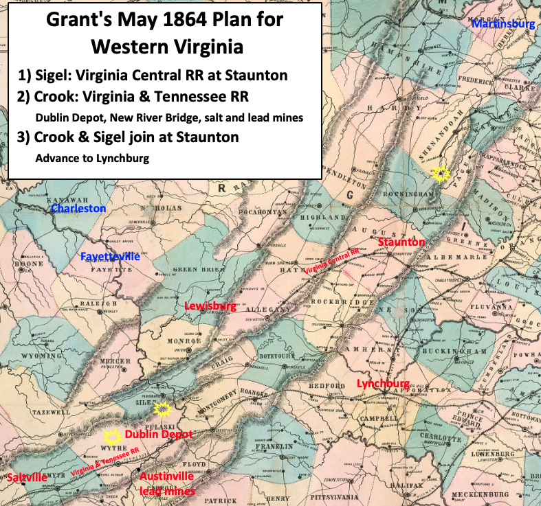
New Union Army leader U.S. Grant's strategy in Virginia was to attack the strongest Confederate Army, Robert E. Lee's Army of Northern Virginia, from multiple fronts. The map shows the plan for wester
1861 · Library of Congress

Union Approach to Wytheville 1863
1863 · Library of Congress
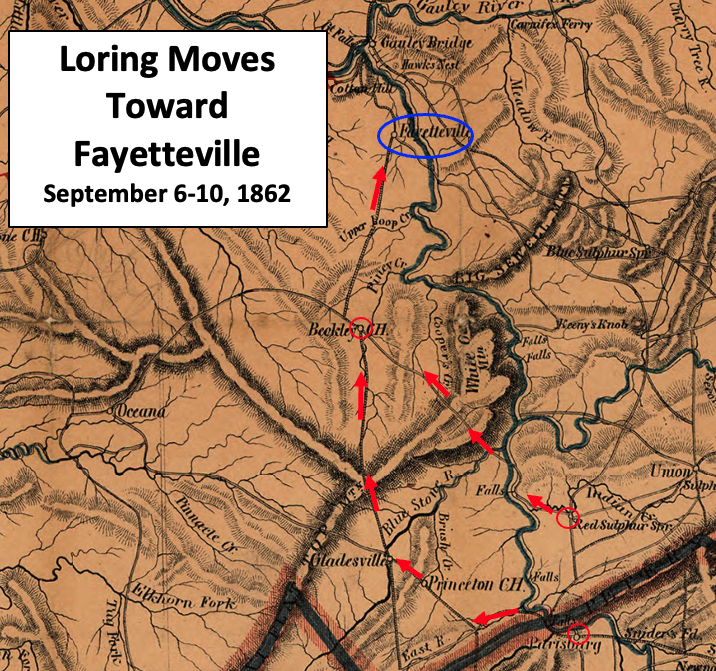
Loring Moves Toward Fayetteville
1864 · Wikimedia Commons

Approach to Wytheville 2 1863
1863 · Library of Congress

Averells Return May 1864 V2
1861 · Library of Congress

Averell Approach to Moorefield
1912 · Library of Congress

Wytheville Raid Map
1862 · Library of Congress