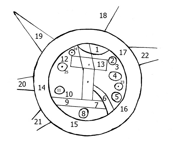

skeleton map of Babylonian World Map
- Date
- 2009
- Mapmaker / publisher
- EvgenyGenkin
- Place
- Babylonia
- Archive
- Wikimedia Commons
- Type
- map
- Original size
- 585 × 480 pixels
Public domain
Reason: public domain: self.
This status rests on the map's publication history, as researched by Wikimedia Commons. Check it before commercial use.
Read from: Commons licence category: PD-self; no CC BY, CC BY-SA, GFDL or deletion tag on the file page.
Credit line
"skeleton map of Babylonian World Map" (2009). EvgenyGenkin, via Wikimedia Commons. Public domain. https://commons.wikimedia.org/wiki/File:BabylonianWorldMap2.jpgNeed maps for a whole project? Add Find Any Map to Claude and ask for this one by its id: 144656.
More like this

Meissner Babylonien und Assyrien clay map 1925
1925 · Wikimedia Commons

Babylonian Map of the World, 700-500 BC
1500 · Wikimedia Commons

Geography 004 - Babylonian Map of the World - Interpretation
Wikimedia Commons

An illustration from the Encyclopaedia Biblica, a 1903 publication which is now in the public domain. Map 1 for article "Geography". Map of the world, by Strabo
1903 · Wikimedia Commons

World according to Herodotus (1888) crop
1888 · Wikimedia Commons

Geography 015 - Ancient Greece Map of the World - c. 5th century BCE
Wikimedia Commons

World map according to Posidonius (150-130 B.C.)
Wikimedia Commons
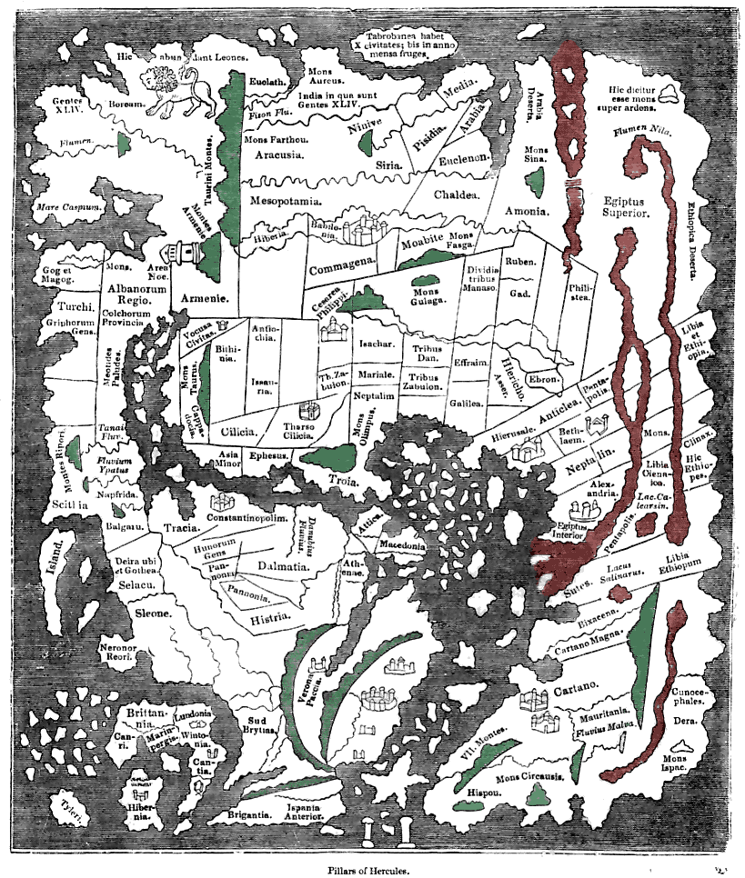
Tracing of the 'Cotton' Anglo-Saxon world map (British Library; Cotton MSS, Tib. B. V, folio 56.; date probably about AD 1000) as published ca. 1836 with printed place-names. Ceylon ("Taprobanea") is
1836 · Wikimedia Commons