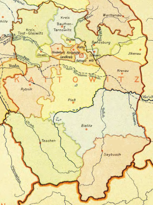

Regierungsbezirk Kattowitz
Map of "Gau Oberschlesien", 1943
- Date
- 1943
- Mapmaker / publisher
- Reichsstelle für das Schul- und Unterrichtsschrifttum
- Place
- Nazi Germany
- Archive
- Wikimedia Commons
- Type
- map
- Original size
- 585 × 782 pixels
Public domain
Reason: its maker died long enough ago that the copyright has expired.
This status rests on the map's publication history, as researched by Wikimedia Commons. Check it before commercial use.
Read from: Commons licence category: PD Old; no CC BY, CC BY-SA, GFDL or deletion tag on the file page.
Credit line
"Regierungsbezirk Kattowitz" (1943). Reichsstelle für das Schul- und Unterrichtsschrifttum, via Wikimedia Commons. Public domain. https://commons.wikimedia.org/wiki/File:Regierungsbezirk_Kattowitz_(1943).pngNeed maps for a whole project? Add Find Any Map to Claude and ask for this one by its id: 23639.
More like this

Gau Oberschlesien
1943 · Wikimedia Commons

Gau Oberschlesien-Ostoberschlesien
1943 · Wikimedia Commons

Bezirk Bielitz Sprachinsel 1910
c. 1920 · Wikimedia Commons

III Reich - Ober und Niederschlesien
1940 · Wikimedia Commons

Karte Oberschlesiens 1818
1818 · Wikimedia Commons

Schlesien 1905
1905 · Wikimedia Commons

Map from "The Handbook on German Military Forces (TM-E 30-451)" a publication of the War departement, Military Intelligence Division, March 1945.
1945 · Wikimedia Commons

Andrees Handatlas 1912 - Oberschlesisches Berg- und Hütten-Revier
1912 · Wikimedia Commons