

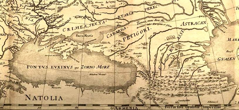
Portuguese map of Asia, 1630 cropped
1630 Portuguese map of Asia, entitled Taboas geraes de toda a navegação, divididas e emendadas por Dom Ieronimo de Attayde com todos os portos principaes das conquistas de Portugal delineadas por Ioão Teixeira cosmographo de Sua Magestade, anno de 1630 (General tables of all the navigation, divided and corrected by D. Jeronimo de Ataide, with all the ports and conquests of Portugal delineated by Joao Teixeira, cosmographer of His Majesty, Year 1630"
- Date
- 1630
- Mapmaker / publisher
- Portuguese_map_of_Asia,_1630.jpg: Jeronimo de Ataide, João Teixeira *derivative work: Geagea ( talk )
- Place
- the Caucasus
- Archive
- Wikimedia Commons
- Type
- map
- Original size
- 1,156 × 469 pixels
Public domainsafest
Reason: its maker died more than 100 years ago, and a faithful scan of a flat work adds no new copyright.
Read from: Commons licence category: PD-Art (PD-old-100); no CC BY, CC BY-SA, GFDL or deletion tag on the file page.
Credit line
"Portuguese map of Asia, 1630 cropped" (1630). Portuguese_map_of_Asia,_1630.jpg: Jeronimo de Ataide, João Teixeira *derivative work: Geagea ( talk ), via Wikimedia Commons. Public domain. https://commons.wikimedia.org/wiki/File:Portuguese_map_of_Asia,_1630_cropped.jpgNeed maps for a whole project? Add Find Any Map to Claude and ask for this one by its id: 141629.
More like this

Portugues map of India, 1630
1630 · Wikimedia Commons

Portuguese map of Asia, 1630
1630 · Wikimedia Commons

Fernão Vaz Dourado 1570-1 Caucasus
1570 · Wikimedia Commons

Map Diego Ribero 1529 Asia
1529 · Wikimedia Commons

Fernão Vaz Dourado 1570-1 Black Sea
1570 · Wikimedia Commons

Kunyu Wanguo Quantu (坤輿萬國全圖).Caucasus
1604 · Wikimedia Commons

Gerard de Jode version, Prime Partos Asia (Antwerp, 1577).A
1577 · Wikimedia Commons
Fedor chertezh cropped
1614 · Wikimedia Commons