

Fernão Vaz Dourado 1570-1 Caucasus
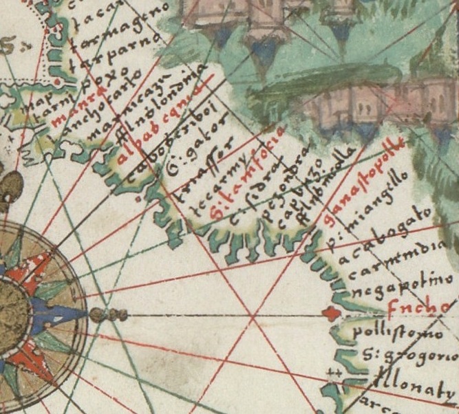
Nautical chart of Portuguese cartographer Fernão Vaz Dourado (c. 1520 - c. 1580), part of a nautical atlas drawn in 1570 and now kept in the Huntington Library, San Marino, USA.
- Date
- 1570
- Mapmaker / publisher
- Fernão_Vaz_Dourado_1570-1.jpg: Fernão Vaz Dourado (c. 1520 - c. 1580) * Photographer: Alvesgaspar. Photo taken in 2008 *derivative work: Geagea ( talk )
- Place
- the Caucasus
- Archive
- Wikimedia Commons
- Type
- chart
- Original size
- 1,837 × 691 pixels
Public domainsafest
Reason: its maker died more than 100 years ago, and a faithful scan of a flat work adds no new copyright.
Read from: Commons licence category: PD-Art (PD-old-100); no CC BY, CC BY-SA, GFDL or deletion tag on the file page.
Credit line
"Fernão Vaz Dourado 1570-1 Caucasus" (1570). Fernão_Vaz_Dourado_1570-1.jpg: Fernão Vaz Dourado (c. 1520 - c. 1580) * Photographer: Alvesgaspar. Photo taken in 2008 *derivative work: Geagea ( talk ), via Wikimedia Commons. Public domain. https://commons.wikimedia.org/wiki/File:Fern%C3%A3o_Vaz_Dourado_1570-1_Caucasus.JPGNeed maps for a whole project? Add Find Any Map to Claude and ask for this one by its id: 238478.
More like this

Fernão Vaz Dourado 1575-1
1575–2008 · Wikimedia Commons

Fernão Vaz Dourado 1571-1
1571–2008 · Wikimedia Commons

Portuguese map of Asia, 1630 cropped
1630 · Wikimedia Commons

Portolano of the Mediterranean Sea
1575 · Wikimedia Commons
Europe and northern Africa. HM 29. PORTOLAN ATLAS, anonymous (Dieppe, 1547).G
1547 · Wikimedia Commons

Vesconte Maggiolo. World chart, from eastern coasts of America to India. PORTOLAN CHART. Naples, 1516.H
1516 · Wikimedia Commons

Europe and northern Africa. HM 29. PORTOLAN ATLAS, anonymous (Dieppe, 1547).F
1547 · Wikimedia Commons

Map of the Russia and Near East. HM 33
c. 1578 · Wikimedia Commons