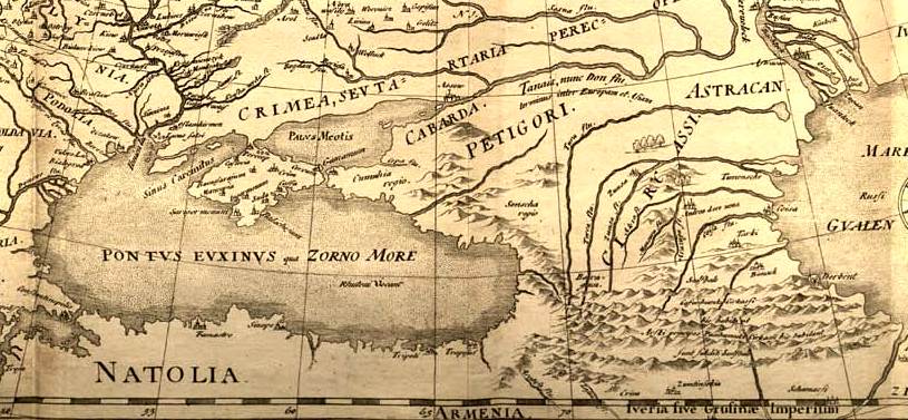

Fedor chertezh cropped
Map of Muscovy (the so-called Fedor Godunov map)
- Date
- 1614
- Mapmaker / publisher
- Fedor_chertezh.jpeg: Hessel Gerritsz *derivative work: Geagea ( talk )
- Place
- the Caucasus
- Archive
- Wikimedia Commons
- Type
- map
- Original size
- 815 × 377 pixels
Public domainsafest
Reason: its maker died more than 100 years ago, and a faithful scan of a flat work adds no new copyright.
Read from: Commons licence category: PD-Art (PD-old-100); no CC BY, CC BY-SA, GFDL or deletion tag on the file page.
Credit line
"Fedor chertezh cropped" (1614). Fedor_chertezh.jpeg: Hessel Gerritsz *derivative work: Geagea ( talk ), via Wikimedia Commons. Public domain. https://commons.wikimedia.org/wiki/File:Fedor_chertezh_cropped.jpgNeed maps for a whole project? Add Find Any Map to Claude and ask for this one by its id: 240538.
More like this

Atlas Cosmographicae (Mercator) 035 cropped
1596 · Wikimedia Commons

Europe map ca1570 cropped Caucasus
c. 1570 · Wikimedia Commons

A. de La Motraye. Mare Nigrum (17 century) (cropped3)
Wikimedia Commons

A. de La Motraye. Mare Nigrum (17 century) (cropped2)
Wikimedia Commons

Nicolas Sanson. Estats de l'Empire du Grand Seigneur des Turqs ou Sultan des Ottomans. 1654. Caucasus
1654 · Wikimedia Commons

Guillaume Sanson - Estats de l'Empire du Grand Seigneur des Turcs - 1681 - North-West Caucasus crop
1681 · Wikimedia Commons

A. de La Motraye. Mare Nigrum (17 century) (cropped4)
Wikimedia Commons

Fernão Vaz Dourado 1570-1 Caucasus
1570 · Wikimedia Commons