

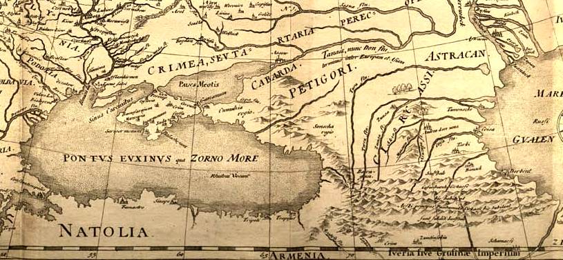
Europe map ca1570 cropped Caucasus
Map of Europe, drawing of c. 1570
- Date
- c. 1570
- Mapmaker / publisher
- Europe_map_ca1570.jpg
- Place
- Georgia
- Archive
- Wikimedia Commons
- Type
- map
- Original size
- 780 × 466 pixels
Public domainsafest
Reason: its maker died more than 100 years ago, and a faithful scan of a flat work adds no new copyright.
Read from: Commons licence category: PD-Art (PD-old-100); no CC BY, CC BY-SA, GFDL or deletion tag on the file page.
Credit line
"Europe map ca1570 cropped Caucasus" (c. 1570). Europe_map_ca1570.jpg, via Wikimedia Commons. Public domain. https://commons.wikimedia.org/wiki/File:Europe_map_ca1570_cropped_Caucasus.jpgNeed maps for a whole project? Add Find Any Map to Claude and ask for this one by its id: 239964.
More like this

Atlas Cosmographicae (Mercator) 035 cropped
1596 · Wikimedia Commons
Fedor chertezh cropped
1614 · Wikimedia Commons

Map of Angelino Dulcert cropped. Georgia
1339 · Wikimedia Commons

Cosmography (Cosmographia Claudii Ptolomaei Alexandrini)
1467 · Wikimedia Commons

Map of Europe by Abraham Ortelius (
1571 · Wikimedia Commons

Karta iugo-vostochnoi Rossii Seb. Miunstera iz latinskago izdaniia Kosmografii, 1559g. Tekst str.7; Alternate Title: A map of South-Eastern Russia by Seb.Munster from Latin edition of Cosmography, 1559. Text p.7
1559 · New York Public Library

A. de La Motraye. Mare Nigrum (17 century) (cropped2)
Wikimedia Commons

A. de La Motraye. Mare Nigrum (17 century) (cropped3)
Wikimedia Commons