

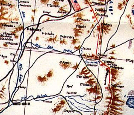
Plano provisorio frontera Chile-bolivia 1904
Provisional map with the border demarcation between Chile and Bolivia according to the 1904 peace treaty.
- Date
- 1904
- Mapmaker / publisher
- Lit. Suiza, Santiago, Oficina de Límites
- Place
- Chile
- Archive
- Wikimedia Commons
- Type
- map
- Original size
- 824 × 2,236 pixels
Public domain
Reason: public domain: Chile.
This status rests on the map's publication history, as researched by Wikimedia Commons. Check it before commercial use.
Read from: Commons licence category: PD-Chile; no CC BY, CC BY-SA, GFDL or deletion tag on the file page.
Credit line
"Plano provisorio frontera Chile-bolivia 1904" (1904). Lit. Suiza, Santiago, Oficina de Límites, via Wikimedia Commons. Public domain. https://commons.wikimedia.org/wiki/File:Plano_provisorio_frontera_Chile-bolivia_1904.jpgNeed maps for a whole project? Add Find Any Map to Claude and ask for this one by its id: 306286.
More like this
Silala en mapa 1904
1904 · Wikimedia Commons

Border Peru-Chile acc. 1929 Treaty
c. 1929 · Wikimedia Commons

Mapa del laudo de 1902 entre Argentina y Chile en la zona del Campo de Hielo Patagónico Sur
1902 · Wikimedia Commons

Chile-Peru border region.
1974 · Library of Congress

Map of Bolivia
1894 · Wikimedia Commons

Mapa de Bolivia por Eduardo Idiaquez, 1901
1901 · Wikimedia Commons

EB1911 Bolivia map
1911 · Wikimedia Commons

MAPA DE LA REGION AUSTRAL DE CHILE, 1904. Se reproduce aqui parcialmente, el «Mapa de la region austral de Chile, provincias de Llanquihue, Chiloe y territorio de Magallanes, formado con los estudios
1904 · Wikimedia Commons