

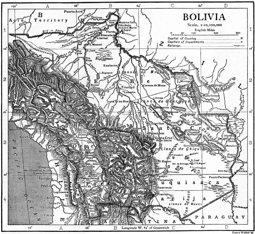
Map of Bolivia
This 1894 map of Bolivia highlights the country’s main geographic features, including the Andes Mountains in the west and the lowlands in the east. The map shows major towns and cities, the capitals of departments, departmental borders, completed and projected railroads, highways, and navigable rivers. Mines for copper, gold, silver, and tin are indicated, reflecting Bolivia’s role as a major mineral producer. Neighboring parts of Brazil, Paraguay, Argentina, Chile, and Peru are shown. Territory in the northeastern part of the country, near the border with Brazil, is identified as “Unexplored.” An unusual feature of the map is the setting of the prime meridian at the capital city of La Paz (approximately 68° W), rather than at Greenwich, United Kingdom, which was standard practice among mapmakers at that time. The map was issued by William M. Bradley & Company, a prominent late-19th century publisher of maps and atlases based in Philadelphia.
- Date
- 1894
- Place
- Argentina
- Archive
- Wikimedia Commons
- Type
- map
- Original size
- 1,024 × 1,679 pixels
Public domainsafest
Reason: its maker died more than 100 years ago, and a faithful scan of a flat work adds no new copyright.
Read from: Commons licence category: PD-Art (PD-old-100); no CC BY, CC BY-SA, GFDL or deletion tag on the file page.
Credit line
"Map of Bolivia" (1894). Wikimedia Commons. Public domain. https://commons.wikimedia.org/wiki/File:Map_of_Bolivia_WDL11315.pngNeed maps for a whole project? Add Find Any Map to Claude and ask for this one by its id: 306462.
More like this

Map of the Eastern Republic of Uruguay, 1893
1893 · Wikimedia Commons

Mapa de Bolivia por Eduardo Idiaquez, 1901
1901 · Wikimedia Commons

"Base 802149 (R00815) 11-93." Relief shown by shading.
1993 · Library of Congress

Plano provisorio frontera Chile-bolivia 1904
1904 · Wikimedia Commons

Map of Brazil, Bolivia, Paraguay, and Uruguay; Harbor of Rio Janeiro inset; Harbor of Bahia inset; Map of Chili; Island of Juan Fernandez inset.
1863 · New York Public Library
EB1911 Bolivia map
1911 · Wikimedia Commons

Bolivia
1916 · Wikimedia Commons

Extent and Location of the Governments of Santa Cruz de la Sierra, Matogroso, Cuyaba, and Towns of Native Americans Called Chiquitos
1789 · Wikimedia Commons