

Original map created in Microsoft PowerPoint June 12, 2006, by Civil War author Scott Mingus who grants fair usage to Wikipedia.:en:Category:Battle maps of the American Civil War
- Date
- June 12, 2006
- Mapmaker / publisher
- Original uploader was Scott Mingus at en.wikipedia
- Place
- Harrison County, Indiana
- Archive
- Wikimedia Commons
- Type
- map
- Original size
- 433 × 441 pixels
Public domain
Reason: public domain: user.
This status rests on the map's publication history, as researched by Wikimedia Commons. Check it before commercial use.
Read from: Commons licence category: PD-user; no CC BY, CC BY-SA, GFDL or deletion tag on the file page.
Credit line
"Original map created in Microsoft PowerPoint June 12, 2006, by Civil War author Scott Mingus who grants fair usage to Wikipedia.:en:Category:Battle maps of the American Civil War" (June 12, 2006). Original uploader was Scott Mingus at en.wikipedia, via Wikimedia Commons. Public domain. https://commons.wikimedia.org/wiki/File:Morganmap.jpgNeed maps for a whole project? Add Find Any Map to Claude and ask for this one by its id: 756.
More like this

Battles and Leaders of the Civil War
c. 1887 · Wikimedia Commons

Battle of Corydon with Morgan's Raid in southern Indiana copy
November 3, 2008 · Wikimedia Commons

Fort Henry Campaign
January 31, 2006 · Wikimedia Commons

Fort Henry to Fort Donelson
January 31, 2006 · Wikimedia Commons

Map of that portion of the Tennessee River in northern Alabama and Tennessee between Savannah and Chattanooga together with the country adjacent. Taken from Map of Middle Tennessee. Being compiled in 1865 under direction of Col. W. E. Merrill.
1865 · U.S. National Archives

Lightburns Retreat September 1862
1862 · Wikimedia Commons

Map of Louisville defenses during the Civil War, published in June 1865.
1865 · Wikimedia Commons
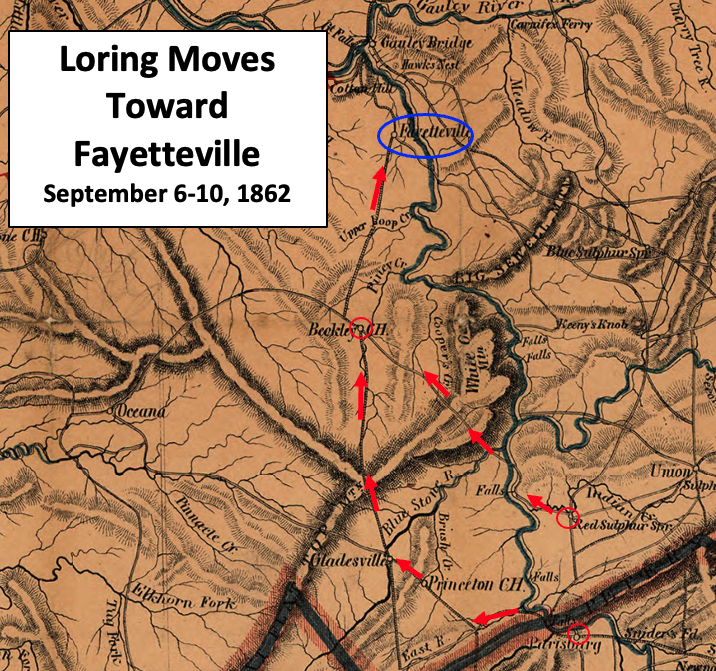
Loring Moves Toward Fayetteville
1864 · Wikimedia Commons