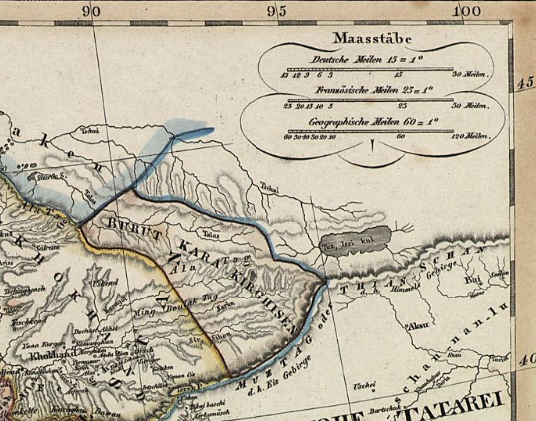

Map of Burut-Kyrgyz
at the beginning of the 19th century
- Date
- 1829
- Mapmaker / publisher
- Adolf Stieler
- Place
- Central Asia
- Archive
- Wikimedia Commons
- Type
- map
- Original size
- 536 × 421 pixels
Public domain
Reason: its maker died long enough ago that the copyright has expired.
This status rests on the map's publication history, as researched by Wikimedia Commons. Check it before commercial use.
Read from: Commons licence category: PD Old; no CC BY, CC BY-SA, GFDL or deletion tag on the file page.
Credit line
"Map of Burut-Kyrgyz" (1829). Adolf Stieler, via Wikimedia Commons. Public domain. https://commons.wikimedia.org/wiki/File:Map_of_Burut-Kyrgyz.pngNeed maps for a whole project? Add Find Any Map to Claude and ask for this one by its id: 241738.
More like this

Map of Central Asia in 1824
1824 · Wikimedia Commons

Westliches Hochasien
1844 · Wikimedia Commons

NKC map before 1859
1831–1859 · Wikimedia Commons

Map of Ladakh or Little Tibet (Klein Tubet) in 1858 Vorder-Asien
1858 · Wikimedia Commons

Tibet map before 1859 detail from Asia - Stieler's Hand-Atlas
1831–1859 · Wikimedia Commons

1838 map of Western Siberia, Independent Tartary, Khiva, Bokhara &c
1838 · Wikimedia Commons

Iran und Turan - Persien, Afghanistan, Biludschistan, Turkestan - eine geographische Skizze
1835 · Library of Congress

General Map of Central Asia - I
1874 · Wikimedia Commons