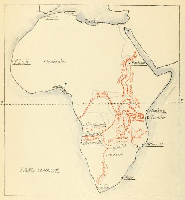

Les explorations du Sud et du Centre africains jusquen 1876
Map of explorations undertaken in Africa until 1876
- Date
- 1913
- Mapmaker / publisher
- Renier, Gustave Ferdinand Joseph
- Place
- the Congo Free State
- Archive
- Wikimedia Commons
- Type
- map
- Original size
- 628 × 677 pixels
Public domain
Reason: its maker died long enough ago that the copyright has expired.
This status rests on the map's publication history, as researched by Wikimedia Commons. Check it before commercial use.
Read from: Commons licence category: PD Old; no CC BY, CC BY-SA, GFDL or deletion tag on the file page.
Credit line
"Les explorations du Sud et du Centre africains jusquen 1876" (1913). Renier, Gustave Ferdinand Joseph, via Wikimedia Commons. Public domain. https://commons.wikimedia.org/wiki/File:Les_explorations_du_Sud_et_du_Centre_africains_jusquen_1876.jpgNeed maps for a whole project? Add Find Any Map to Claude and ask for this one by its id: 239324.
More like this

Etat des connaissances sur lAfrique en 1876
1913 · Wikimedia Commons

Les expeditions de la Societe Internationale Africaine
1913 · Wikimedia Commons

Afrique centrale et australe.
1887 · Wikimedia Commons

Map of explorer's journey
Wikimedia Commons

Standpunkt der Erforschung von Central-und Süd-Afrika bis Septembre 1876
1876 · Wikimedia Commons

AFR V3 D506 Chief Routes of Modern Explorers in the Congo Basin
June 12, 1892 · Wikimedia Commons

AFR V3 D546 Chief Routes of the Explorers in the Congo east of Tanganyika
June 12, 1892 · Wikimedia Commons

Croquis de l'Afrique équatoriale, contenant les derniers renseignements recueillis par les agouts de l'Association internationale du Congo
1885 · Wikimedia Commons