
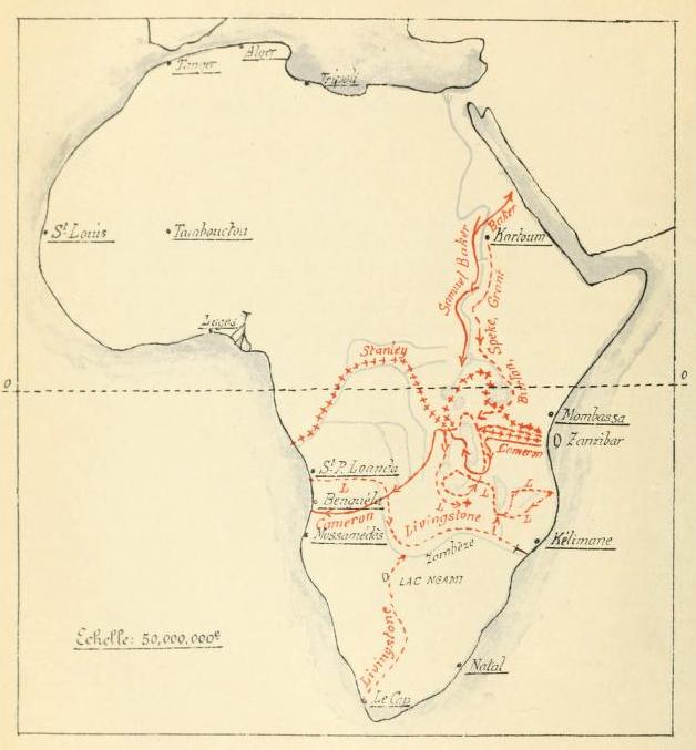
Map of explorer's journey
Map representing the journey followed by the explorers in the book. Most regions and waterways are mentioned in the text which makes this a helpful map when reading
- Mapmaker / publisher
- Charles de Martrin-Donos
- Place
- the Democratic Republic of the Congo
- Archive
- Wikimedia Commons
- Type
- map
- Original size
- 3,999 × 6,369 pixels
Public domain
Reason: a US government work.
This status rests on the map's publication history, as researched by Wikimedia Commons. Check it before commercial use.
Read from: Commons licence category: PD US; no CC BY, CC BY-SA, GFDL or deletion tag on the file page.
Credit line
"Map of explorer's journey". Charles de Martrin-Donos, via Wikimedia Commons. Public domain. https://commons.wikimedia.org/wiki/File:Map_of_explorer%27s_journey.tifNeed maps for a whole project? Add Find Any Map to Claude and ask for this one by its id: 237490.
More like this

Carte du voyage de Cameroun en Afrique
1881 · Cameron

Afrique centrale et australe.
1887 · Wikimedia Commons
Les explorations du Sud et du Centre africains jusquen 1876
1913 · Wikimedia Commons

AFR V3 D506 Chief Routes of Modern Explorers in the Congo Basin
June 12, 1892 · Wikimedia Commons

AFR V3 D539 Chief Routes of the Explorers in the Upper Congo Basin
June 12, 1892 · Wikimedia Commons

AFR V3 D584 Chief Routes of the Explorers in the Kassai Basin
June 12, 1892 · Wikimedia Commons

AFR V3 D528 Lines of Navigation in the Congo Basin
June 12, 1892 · Wikimedia Commons

Fig. VII. — État des connaissances sur le Nil blanc en 1842, après les expéditions égyptiennes
1898 · Wikimedia Commons