

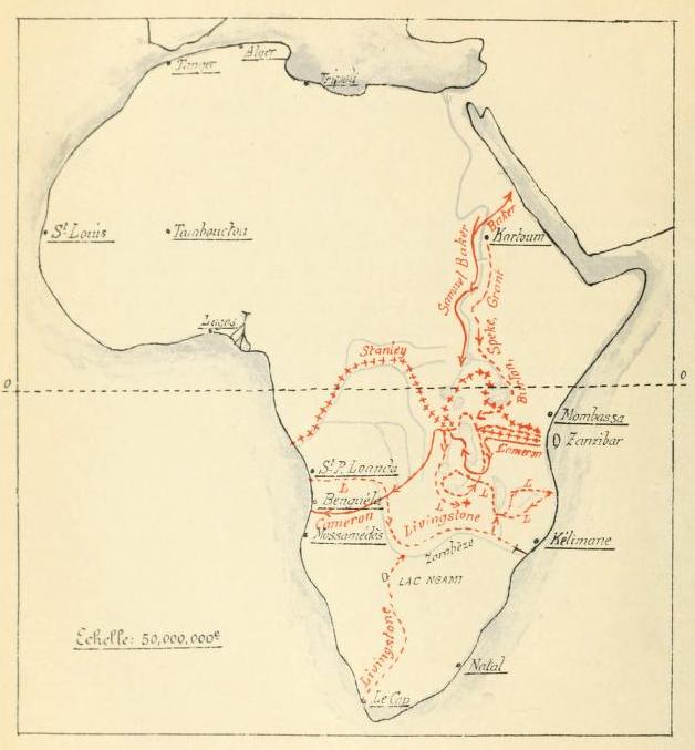
Les expeditions de la Societe Internationale Africaine
Map of explorations undertaken in Africa until 1876
- Date
- 1913
- Mapmaker / publisher
- Renier, Gustave Ferdinand Joseph
- Place
- East Africa
- Archive
- Wikimedia Commons
- Type
- map
- Original size
- 835 × 646 pixels
Public domain
Reason: its maker died long enough ago that the copyright has expired.
This status rests on the map's publication history, as researched by Wikimedia Commons. Check it before commercial use.
Read from: Commons licence category: PD Old; no CC BY, CC BY-SA, GFDL or deletion tag on the file page.
Credit line
"Les expeditions de la Societe Internationale Africaine" (1913). Renier, Gustave Ferdinand Joseph, via Wikimedia Commons. Public domain. https://commons.wikimedia.org/wiki/File:Les_expeditions_de_la_Societe_Internationale_Africaine.pngNeed maps for a whole project? Add Find Any Map to Claude and ask for this one by its id: 237686.
More like this
Les explorations du Sud et du Centre africains jusquen 1876
1913 · Wikimedia Commons

Etat des connaissances sur lAfrique en 1876
1913 · Wikimedia Commons

Afrique Équatoriale traversée du Commandant Cameron de l'Océan Indien a l'Océan Atlantique.
1876 · Wikimedia Commons

East Africa: Sketch Map of Native Routes from Dar Es Salaam Towards the Head of Lake Nyassa from information obtained by Mr. Keith Johnson, R.G.S. East African Expedition
1879 · Wikimedia Commons

Map of Eastern Equatorial Africa in 1849
1849 · Wikimedia Commons

Map to Illustrate the Explorations in Eastern Africa
1866 · Wikimedia Commons

Carte des lacs de l'Afrique Centrale.
1876 · Wikimedia Commons

Explorations de Livingstone dans la Région des Lacs de l'Afrique Orientale
1872 · Wikimedia Commons