

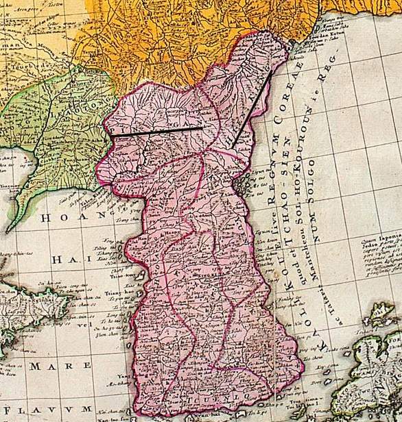
Korean map 1800s
乾坤圖 Korean map 1800s
- Date
- 1800–2007
- Mapmaker / publisher
- PHG (talk)
- Archive
- Wikimedia Commons
- Type
- map
- Original size
- 1,984 × 3,426 pixels
Public domain
Reason: a US government work.
This status rests on the map's publication history, as researched by Wikimedia Commons. Check it before commercial use.
Read from: Commons licence category: PD US; no CC BY, CC BY-SA, GFDL or deletion tag on the file page; Commons tags it as a US government work, but its record names no government maker.
Credit line
"Korean map 1800s" (1800–2007). PHG (talk), via Wikimedia Commons. Public domain. https://commons.wikimedia.org/wiki/File:Korean_map_1800s.jpgNeed maps for a whole project? Add Find Any Map to Claude and ask for this one by its id: 144427.
More like this

Korean map in 1899
1899 · Wikimedia Commons

Kunyu_Quantu_of_Ferdinand_Verbiest_1674
1674 · Wikimedia Commons

Complete Map of the Provinces of the Empire
1750–1800 · Wikimedia Commons

Photo from www.economist.com of a 1763 Chinese map of the world, claiming to be a reproduction of a 1418 map made from Zheng He's voyages. Lui Gang stated he discovered it in 2005 but it is disputed a
1418 · Wikimedia Commons

1763 Chinese map of the world, claiming to incorporate information from a 1418 map. Discovered by Liu Gang in 2005.
1763 · Wikimedia Commons

One map shows Ming Empire of China and the other map shows the world. Relief shown pictorially. Pen-and-ink and watercolor. Title from verso in red ink: Chʻŏnha Chungguk. Possibly based on early map (
1800 · Library of Congress

Coastal map of China, Hai jiang yang jie xing shi tu (海疆洋界形勢圖), between 1787 and 1801 AD, from the - master-gmd-gmd7-g7822-g7822c-ct003413a
1787–1801 · Wikimedia Commons
Joseon at its end
1749 · Wikimedia Commons