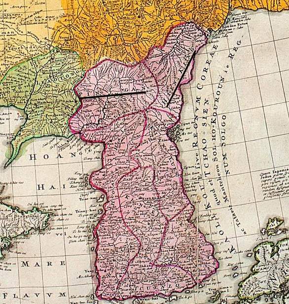

Joseon at its end
Detail of Korea c. 1749, but based on J.B.B. d'Anville's earlier maps of the 1720s and 1730s, chiefly based on Jesuit and Qing maps of the 1710s and 1720s at the height of the Joseon dynasty. Pingan and Hienking underlined for no apparent reason.
- Date
- 1749
- Place
- Korea
- Archive
- Wikimedia Commons
- Type
- map
- Original size
- 586 × 616 pixels
Public domainsafest
Reason: its maker died more than 100 years ago.
Read from: Commons licence category: PD-old-100-expired; no CC BY, CC BY-SA, GFDL or deletion tag on the file page.
Credit line
"Joseon at its end" (1749). Wikimedia Commons. Public domain. https://commons.wikimedia.org/wiki/File:Joseon_at_its_end.jpgNeed maps for a whole project? Add Find Any Map to Claude and ask for this one by its id: 240903.
More like this

Der Jesuiten-Atlas der Kanghsi-Zeit - China und die Aussenlaender
1721–1941 · Plate 20

Map of Quantong Province or Lyau-tong (Liaodong) and of the Kingdom of Kau-li (Gaoli) or Korea for the Universal History of a Society of Men of Letters.
1750 · Wikimedia Commons

China nebst Corea und den benachbarten Laendern der Tartary aus denen Karten genommen, welche die Jesuiten von dem Jahre 1708 bis 1717 davon entworfen haben.
1749 · Library of Congress

Delisle Asie3
1700 · Wikimedia Commons

Delisle Asie3b
1700 · Wikimedia Commons

Map of China and Korea
1749 · Wikimedia Commons

Chosŏn chido.
1730 · Library of Congress

Korean map in 1899
1899 · Wikimedia Commons