

Harta Iozefina a Banatului background 1769-72
- Date
- 1769–1772
- Mapmaker / publisher
- Historische Militärkarte der österreichisch-ungarischen Monarchie
- Place
- Serbia
- Archive
- Wikimedia Commons
- Type
- map
- Original size
- 800 × 976 pixels
Public domainsafest
Reason: its maker died more than 100 years ago.
Read from: Commons licence category: PD-old-100-expired; no CC BY, CC BY-SA, GFDL or deletion tag on the file page.
Credit line
"Harta Iozefina a Banatului background 1769-72" (1769–1772). Historische Militärkarte der österreichisch-ungarischen Monarchie, via Wikimedia Commons. Public domain. https://commons.wikimedia.org/wiki/File:Harta_Iozefina_a_Banatului_background_1769-72.jpgNeed maps for a whole project? Add Find Any Map to Claude and ask for this one by its id: 251193.
More like this

Map portion of Vojvodina region, from "Josephinische Landesaufnahme"
c. 1770 · Wikimedia Commons
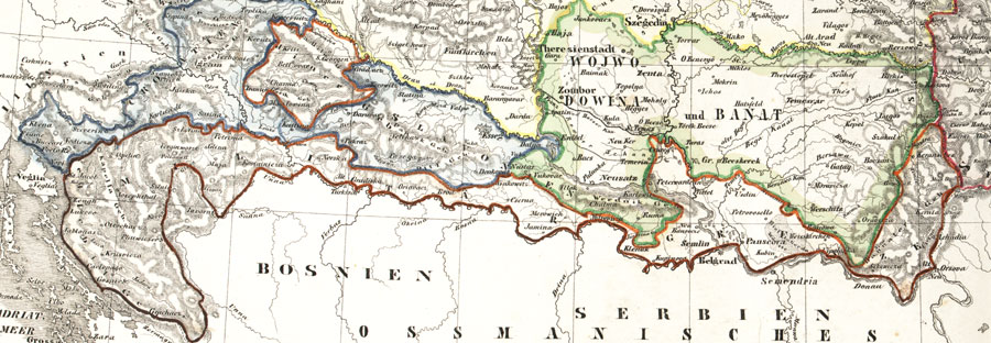
Militargrenze, Wojwodowena und Banat
19th century · Wikimedia Commons

Rascia Banat02
Wikimedia Commons

Neu-Geographisch vorgestelltes Ungarisches Kriegs-Theatrum in Servien une dem Bannat Temeswar
1717 · 2 sheets

Josephinische Landesaufnahme Wien
1764–1787 · Wikimedia Commons

Ca. 1738 map of Serbia and Bosnia by Johann Friedrich Oettinger
c. 1738 · Wikimedia Commons

Military Administration in Serbia
July 31, 2011 · Wikimedia Commons

Eyalet of temesvar1699-sr
2013 · Wikimedia Commons