

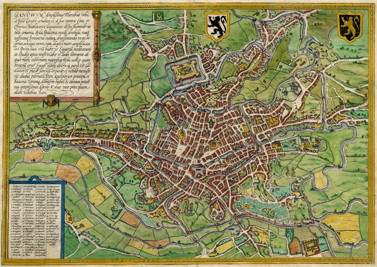
Ghent, Belgium, Braun & Hogenberg, 1572-1624
Antique map of Gent by Braun & Hogenberg Gandavum - Braun & Hogenberg, 1572-1624. Bird's-eyeplan of Ghent. Copper engraving Size: 34 x 48.5cm (13.3 x 18.9 inches) Verso text: Latin Condition: Old coloured. From: Civitates Orbis Terrarum,. Part 1. Köln, 1572-1624.
- Date
- 1572–1624
- Mapmaker / publisher
- Braun_&_Hogenberg
- Place
- Ghent by Braun & Hogenberg
- Archive
- Wikimedia Commons
- Type
- map
- Original size
- 1,500 × 1,056 pixels
Public domainsafest
Reason: its maker died more than 100 years ago, and a faithful scan of a flat work adds no new copyright.
Read from: Commons licence category: PD-Art (PD-old-100); no CC BY, CC BY-SA, GFDL or deletion tag on the file page.
Credit line
"Ghent, Belgium, Braun & Hogenberg, 1572-1624" (1572–1624). Braun_&_Hogenberg, via Wikimedia Commons. Public domain. https://commons.wikimedia.org/wiki/File:Ghent,_Belgium,_Braun_%26_Hogenberg,_1572-1624.jpgNeed maps for a whole project? Add Find Any Map to Claude and ask for this one by its id: 140410.
More like this

Gandavum, amplissima Flandriae urbs, a Julio Caesare condita. / Hadria. Barl.
1574 · Wikimedia Commons
Ghent, Belgium; Braun & Hogenberg 1576
1576 · Wikimedia Commons

Gandaaum, Braun and Hogenberg
1618 · Wikimedia Commons

Gandavum, amplissima Flandriae urbs.
1645 · Ghent, plate 1 of 2

Beschreibung der Städt der Welt / Braun & Hogenberg
1582 · Ghent, plate 59 of 378

Braun Gent HAAB
Wikimedia Commons

Ghent, Belgium, Braun & Hogenberg, 1572 B&W
1572 · Wikimedia Commons

Map of Ghent by Braun and Hogenberg
Wikimedia Commons