

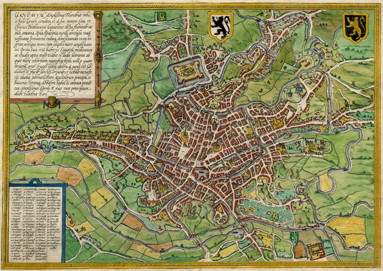
Gandavum, amplissima Flandriae urbs.
Ghent, plate 1 of 2
- Date
- 1645
- Mapmaker / publisher
- Braun, Georg (1541-1622). Éditeur scientifique Hogenberg, Frans (1539?-1590?). Graveur Van Belle, Jérôme. Traducteur
- Place
- Ghent by Braun & Hogenberg
- Archive
- Wikimedia Commons
- Type
- map
- Original size
- 6,480 × 4,896 pixels
Public domainsafest
Reason: its US copyright has expired (published before 1931).
Read from: Commons licence category: PD US expired; no CC BY, CC BY-SA, GFDL or deletion tag on the file page.
Credit line
"Gandavum, amplissima Flandriae urbs." (1645). Braun, Georg (1541-1622). Éditeur scientifique Hogenberg, Frans (1539?-1590?). Graveur Van Belle, Jérôme. Traducteur, via Wikimedia Commons. Public domain. https://commons.wikimedia.org/wiki/File:Gandavum,_amplissima_Flandriae_urbs..._-_btv1b53178907z_(1_of_2).jpgNeed maps for a whole project? Add Find Any Map to Claude and ask for this one by its id: 140431.
More like this

Beschreibung der Städt der Welt / Braun & Hogenberg
1582 · Ghent, plate 59 of 378

Gandavum, amplissima Flandriae urbs, a Julio Caesare condita. / Hadria. Barl.
1574 · Wikimedia Commons

Braun Gent HAAB
Wikimedia Commons
Ghent, Belgium; Braun & Hogenberg 1576
1576 · Wikimedia Commons

Ghent, map 1572
1572 · Wikimedia Commons

Gandaaum, Braun and Hogenberg
1618 · Wikimedia Commons

Map of Ghent by Braun and Hogenberg
Wikimedia Commons

Brugae, Flandricarum urbium ornamenta
1645 · Bruges, plate 1 of 2