

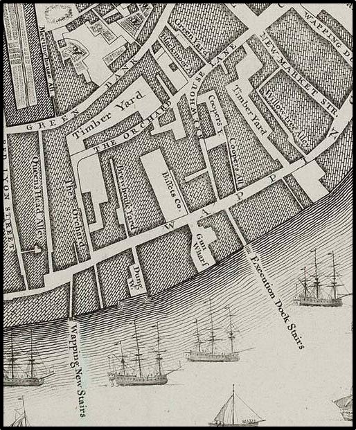
Gacoyne's chart shop, Wapping
The premises of Joel Gascoyne, chartmaker, at "Ye Signe of ye Platt neare Wapping Old Stayres three doares below ye Chapell", 1675-89 - as shown on his own map of the Parish of Stepney of 1703
- Date
- 1703
- Mapmaker / publisher
- Joel Gascoyne (1650-1704)
- Place
- London
- Archive
- Wikimedia Commons
- Type
- chart
- Original size
- 907 × 761 pixels
Public domainsafest
Reason: its maker died more than 70 years ago.
Read from: Commons licence category: PD-old-70-expired; no CC BY, CC BY-SA, GFDL or deletion tag on the file page.
Credit line
"Gacoyne's chart shop, Wapping" (1703). Joel Gascoyne (1650-1704), via Wikimedia Commons. Public domain. https://commons.wikimedia.org/wiki/File:Gacoyne%27s_chart_shop,_Wapping.jpgNeed maps for a whole project? Add Find Any Map to Claude and ask for this one by its id: 291611.
More like this

Gascoyne's Stepney (church)
1703 · Wikimedia Commons

Joel Gascoyne's Spitalfields
1703 · Wikimedia Commons

Joel Gascoyne's Limehouse
1703 · Wikimedia Commons

The Limehouse end of the Limehouse Cut c.1800
1799 · Wikimedia Commons
Rocque x1746
1746 · Wikimedia Commons

Gascoyne's map of 1703 Mile End (fragment)
1703 · Wikimedia Commons

Blome map, 1775, showing location of Whitechapel Mount
1755 · Wikimedia Commons

A map of the Parish of St Mary White Chappel
1720 · BM Heal,Topography.231