

Joel Gascoyne's Spitalfields
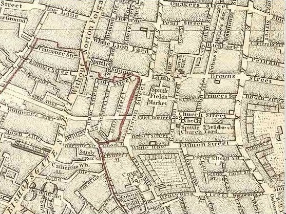
Detail from Joel Gascoyne's map of the Parish of St Dunstan Stepney, 1703, showing the Spitalfields area and surroundings. The arrow indicates Spitalfields Market. The challenge was to map a highly built up area using the surveying tools and methods of the era.
- Date
- 1703
- Mapmaker / publisher
- Joel Gascoyne (c.1650-1704)
- Place
- London
- Archive
- Wikimedia Commons
- Type
- map
- Original size
- 2,040 × 2,806 pixels
Public domainsafest
Reason: its maker died more than 70 years ago.
Read from: Commons licence category: PD-old-70-expired; no CC BY, CC BY-SA, GFDL or deletion tag on the file page.
Credit line
"Joel Gascoyne's Spitalfields" (1703). Joel Gascoyne (c.1650-1704), via Wikimedia Commons. Public domain. https://commons.wikimedia.org/wiki/File:Joel_Gascoyne%27s_Spitalfields.jpgNeed maps for a whole project? Add Find Any Map to Claude and ask for this one by its id: 291613.
More like this

Gascoyne's map of 1703 Mile End (fragment)
1703 · Wikimedia Commons

Gascoyne's Stepney (church)
1703 · Wikimedia Commons

Gacoyne's chart shop, Wapping
1703 · Wikimedia Commons

The Limehouse end of the Limehouse Cut c.1800
1799 · Wikimedia Commons

Spittle Fields and places adjacent taken from ye last survey with corrections
1720 · BM Heal,Topography.229
Map of Spitalfields Area - 1787
1787 · Wikimedia Commons

Blome map, 1775, showing location of Whitechapel Mount
1755 · Wikimedia Commons

Goodman's Field, cropped from John Rocque 1746 2f
1746 · Library of Congress