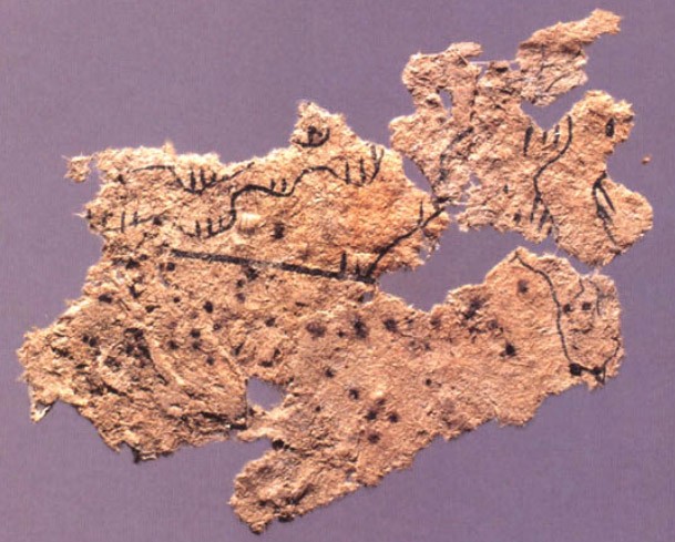

Fangmatan paper map
Fragment of a paper map showing topographic features drawn in black ink, found on the chest of the occupant of Tomb 5 of Fangmatan, Gansu in 1986. The tomb dates to the early Western Han (i.e. early 2nd century BC). Size: 5.6 × 2.6 cm.
- Place
- the Western Han Dynasty
- Archive
- Wikimedia Commons
- Type
- map
- Original size
- 609 × 489 pixels
Public domain
Reason: public domain: scan (PD-old-70).
This status rests on the map's publication history, as researched by Wikimedia Commons. Check it before commercial use.
Read from: Commons licence category: PD-scan (PD-old-70); no CC BY, CC BY-SA, GFDL or deletion tag on the file page.
Credit line
"Fangmatan paper map". Wikimedia Commons. Public domain. https://commons.wikimedia.org/wiki/File:Fangmatan_paper_map.jpgNeed maps for a whole project? Add Find Any Map to Claude and ask for this one by its id: 144623.
More like this

Western Han Mawangdui Silk Map
Wikimedia Commons

Mawangdui Topographic Map
Wikimedia Commons

Topography and notable geographical features of the whole Yuan empire (chinese: Shengchao hunyi fangyu shenglan), China, Yuan dynasty, between 1297 and 1307. Blockprint, height 15.5 cm, width 9.5 cm.
1297 · Wikimedia Commons

Mawangdui Military Map
Wikimedia Commons

Yuji tu - enhanced contrast
Library of Congress

Yu ji tu.
1903 · Library of Congress

Yangzhou in the Quancaoyundaotu
1884 · Library of Congress

Hua yi tu.
1903 · Library of Congress