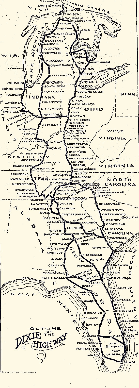

Dixie Highway Map
Map of the Dixie Highway
- Mapmaker / publisher
- Dixie_Highway_Map.gif: Dixie Highway Association *derivative work: Burpelson AFB ( talk )
- Place
- the United States
- Archive
- Wikimedia Commons
- Type
- map
- Original size
- 565 × 1,575 pixels
Public domain
Reason: a US government work.
This status rests on the map's publication history, as researched by Wikimedia Commons. Check it before commercial use.
Read from: Commons licence category: PD US; no CC BY, CC BY-SA, GFDL or deletion tag on the file page.
Credit line
"Dixie Highway Map". Dixie_Highway_Map.gif: Dixie Highway Association *derivative work: Burpelson AFB ( talk ), via Wikimedia Commons. Public domain. https://commons.wikimedia.org/wiki/File:Dixie_Highway_Map.pngNeed maps for a whole project? Add Find Any Map to Claude and ask for this one by its id: 296109.
More like this

United States system of highways, adopted for uniform marking by the American Association of State Highway officials, November 11, 1926, with additions and amendments subsequently approved 1950
1950 · Library of Congress

Take Ichi convoy
Wikimedia Commons

Dixie Highway Map - 2
1922 · Wikimedia Commons

1946 numbering
1946 · Wikimedia Commons

Garrison's Map of Dixie
1909 · Wikimedia Commons

AAA motor routes to Augusta, Georgia, and Florida climate surpassing even the Riviera
1930 · Wikimedia Commons

Map of Proposed National Highways of the United States, 1915
1915 · Wikimedia Commons

Map of United States Proposed National Highways System, 1915
1915 · Wikimedia Commons