

British dominion of India
Map showing British, French, Portuguese and Dutch possessions in India in 1783.
- Date
- 1912
- Mapmaker / publisher
- "The Cambridge Modern History Atlas" edited by Sir Adolphus William Ward, G.W. Prothero, Sir Stanley Mordaunt Leathes, and E.A. Benians. Cambridge University Press; London. 1912
- Place
- India in the 18th century
- Archive
- Wikimedia Commons
- Type
- atlas page
- Original size
- 1,263 × 1,644 pixels
Public domainsafest
Reason: its US copyright has expired (published before 1931).
Read from: Commons licence category: PD US expired; no CC BY, CC BY-SA, GFDL or deletion tag on the file page.
Credit line
"British dominion of India" (1912). "The Cambridge Modern History Atlas" edited by Sir Adolphus William Ward, G.W. Prothero, Sir Stanley Mordaunt Leathes, and E.A. Benians. Cambridge University Press; London. 1912, via Wikimedia Commons. Public domain. https://commons.wikimedia.org/wiki/File:British_dominion_of_India(1783).jpgNeed maps for a whole project? Add Find Any Map to Claude and ask for this one by its id: 256431.
More like this

An overview map of the 1700's (up to 1792) from *Shepherd's "Historical Atlas
1923 · Wikimedia Commons

C. 1700-1792 India
c. 1911 · Wikimedia Commons

This early-20th century map shows the British Empire in India, a complex political structure that was made up of provinces directly ruled by Britain and the Native--or Princely--States, which were rul
1903 · Wikimedia Commons

Political maps of India in the years 1765 and 1805, published in the 'Imperial Gazetteer of India' (Vol. XXVI, Atlas; 1931 revised edition; plate no. 28)
1931 · Wikimedia Commons

Map of India under the British East India Company, comparing 1765 and 1805
1907 · Wikimedia Commons
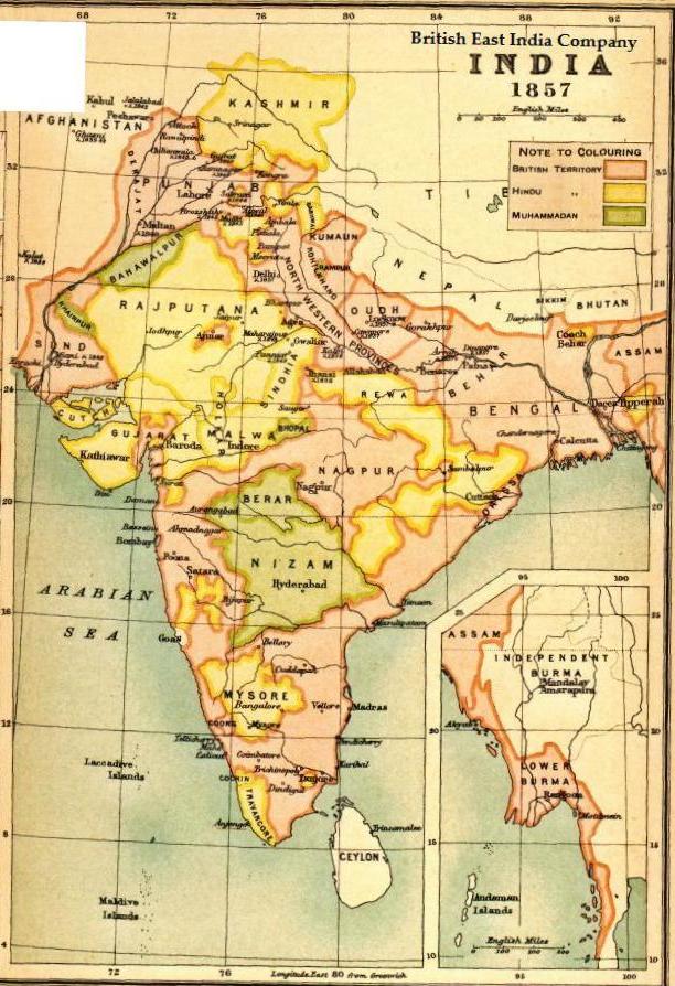
Map BEIC 1857
1857 · Wikimedia Commons

From a map by Robert de Vaugondy (1688-1766), published in 1783
1783 · Wikimedia Commons

This is a detail from a period map showing the major coastal colonial outposts in southern India and Ceylon in 1794. Control of many of these outposts changed hands during the 18th century; which stat
c. 1794 · Wikimedia Commons