

Battle of Stirling's Plantation
Map, Battle of Sterling's Plantation, Louisiana, 1863. Scanned copy of map of engagement during the American Civil War.
- Date
- 1863–1865
- Mapmaker / publisher
- J. Irvine Dungan
- Place
- Pointe Coupee Parish, Louisiana
- Archive
- Wikimedia Commons
- Type
- map
- Original size
- 3,270 × 2,472 pixels
Public domain
Reason: a US government work.
This status rests on the map's publication history, as researched by Wikimedia Commons. Check it before commercial use.
Read from: Commons licence category: PD US; no CC BY, CC BY-SA, GFDL or deletion tag on the file page.
Credit line
"Battle of Stirling's Plantation" (1863–1865). J. Irvine Dungan, via Wikimedia Commons. Public domain. https://commons.wikimedia.org/wiki/File:Battle_of_Stirling%27s_Plantation.jpgNeed maps for a whole project? Add Find Any Map to Claude and ask for this one by its id: 921.
More like this
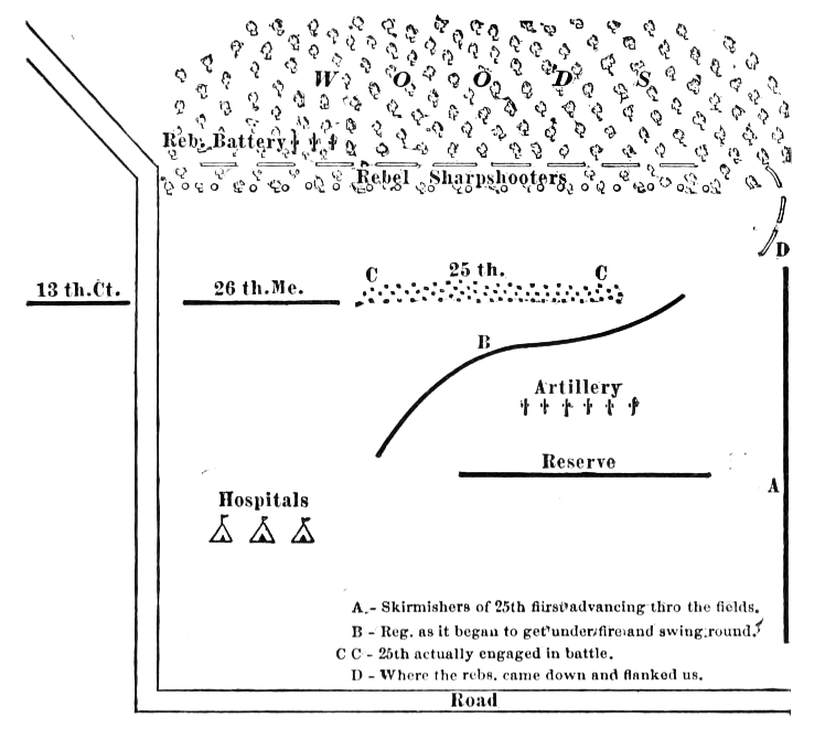
A published adaptation of a rough map of the Battle of Irish Bend, made by Henry Goodell, a lieutenant in the Civil War who was in this skirmish. The "25th" described is the 25th Connecticut Volunteer
1863–1911 · Wikimedia Commons

Stirling's Plantation Battlefield Louisiana
November 2, 2010 · Wikimedia Commons

Baton Rouge Region 1863
1863 · Library of Congress

Fort Jackson Naval Battle
Wikimedia Commons

Fort Butte LaRose 1863
1863 · Library of Congress

Plantations in the vicinity of Lake St. Joseph circa 1866
1866–1874 · Wikimedia Commons

Tomlinson's map of Port Hudson, showing all of the batteries, strongholds, principal plantations etc.
1863 · Library of Congress

Battle of Hendersons Hill Map
1865 · Wikimedia Commons