

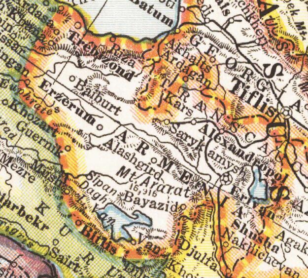
Autonomous Armenia Ottoman proposal 1919,after WWI
Map of the 1919 Ottoman proposal for the creation of autonomous Armenia within Ottoman empire
- Date
- 1919–1920
- Mapmaker / publisher
- Reynolds, Francis J
- Place
- the Near East
- Archive
- Wikimedia Commons
- Type
- map
- Original size
- 720 × 1,454 pixels
Public domain
Reason: a US government work.
This status rests on the map's publication history, as researched by Wikimedia Commons. Check it before commercial use.
Read from: Commons licence category: PD US; no CC BY, CC BY-SA, GFDL or deletion tag on the file page.
Credit line
"Autonomous Armenia Ottoman proposal 1919,after WWI" (1919–1920). Reynolds, Francis J, via Wikimedia Commons. Public domain. https://commons.wikimedia.org/wiki/File:Autonomous_Armenia_Ottoman_proposal_1919,after_WWI.jpgNeed maps for a whole project? Add Find Any Map to Claude and ask for this one by its id: 239250.
More like this

«Armenian Hearth» proposal.Lausanne conference1924
1924 · Wikimedia Commons

Map showing the boundaries of Armenia as awarded by President Wilson
1920 · Wikimedia Commons
Wilsonian Armenia National Geographic 1921
1921 · Wikimedia Commons

Asia Minor and the Caucasus 1919
1922 · Wikimedia Commons

Armenia in Paris Peace Conference 1919
1919 · Wikimedia Commons

1920 Treaty of Sèvres Borders
1920–1922 · Wikimedia Commons

Asia minor-Shepherd 1923 Armenia
1923 · Wikimedia Commons

Boundary between Turkey and Armenia as determined by Woodrow Wilson
August 26, 2012 · Wikimedia Commons