

1920 Treaty of Sèvres Borders
Borders of Turkey and Transcaucasian Republics after the Treaty of Sèvres 1920.
- Date
- 1920–1922
- Mapmaker / publisher
- John George Bartholomew
- Place
- the Near East
- Archive
- Wikimedia Commons
- Type
- map
- Original size
- 823 × 460 pixels
Public domain
Reason: its maker died long enough ago that the copyright has expired.
This status rests on the map's publication history, as researched by Wikimedia Commons. Check it before commercial use.
Read from: Commons licence category: PD Old; no CC BY, CC BY-SA, GFDL or deletion tag on the file page.
Credit line
"1920 Treaty of Sèvres Borders" (1920–1922). John George Bartholomew, via Wikimedia Commons. Public domain. https://commons.wikimedia.org/wiki/File:1920_Treaty_of_S%C3%A8vres_Borders.jpgNeed maps for a whole project? Add Find Any Map to Claude and ask for this one by its id: 239246.
More like this

Treaty of Sèvres,1 Republic of Armenia,Greek Ionia
1920–1922 · Wikimedia Commons

Near East according to the Treaty of Sevres1921~2
1922 · Wikimedia Commons
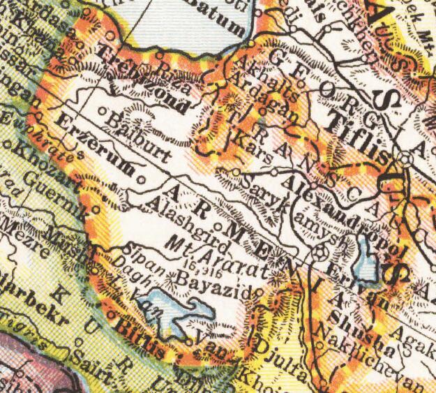
Wilsonian Armenia National Geographic 1921
1921 · Wikimedia Commons

Map illustrating the partitioning of Anatolia according to the Treaty of Sèvres (1920) after World War I.
August 10, 2007 · Wikimedia Commons

Map showing the boundaries of Armenia as awarded by President Wilson
1920 · Wikimedia Commons

Boundary between Turkey and Armenia as determined by Woodrow Wilson
August 26, 2012 · Wikimedia Commons

A 1927 version of map of the Treaty of Sèvres used by the Grand National Assembly of Turkey (later restored).
January 15, 2015 · Wikimedia Commons

Treaty of Sèvres map partitioning Anatolia
September 19, 2007 · Wikimedia Commons