

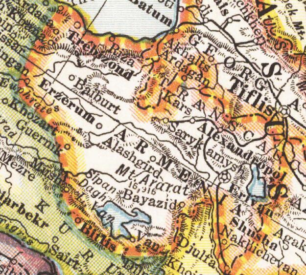
Near East according to the Treaty of Sevres1921~2
Borders of the Near East according to the Treaty of Sevres in 1921-1922
- Date
- 1922
- Mapmaker / publisher
- George Phillip
- Place
- Europe
- Archive
- Wikimedia Commons
- Type
- map
- Original size
- 1,286 × 658 pixels
Public domain
Reason: its maker died long enough ago that the copyright has expired.
This status rests on the map's publication history, as researched by Wikimedia Commons. Check it before commercial use.
Read from: Commons licence category: PD Old; no CC BY, CC BY-SA, GFDL or deletion tag on the file page.
Credit line
"Near East according to the Treaty of Sevres1921~2" (1922). George Phillip, via Wikimedia Commons. Public domain. https://commons.wikimedia.org/wiki/File:Near_East_according_to_the_Treaty_of_Sevres1921~2.jpgNeed maps for a whole project? Add Find Any Map to Claude and ask for this one by its id: 242786.
More like this

Asia Minor Armenia Caucasus 1921~2
1922 · Wikimedia Commons

Treaty of Sèvres,1 Republic of Armenia,Greek Ionia
1920–1922 · Wikimedia Commons
Wilsonian Armenia National Geographic 1921
1921 · Wikimedia Commons

1920 Treaty of Sèvres Borders
1920–1922 · Wikimedia Commons

Mideast1920 cropped
1920 · Wikimedia Commons

Asia Minor and the Caucasus 1919
1922 · Wikimedia Commons

Mideast1920
1920 · Wikimedia Commons

Map of Greater Greece (Greek Mandate, Zone of the Straits) Southeast Europe and Asia Minor 1922
1922 · Wikimedia Commons