

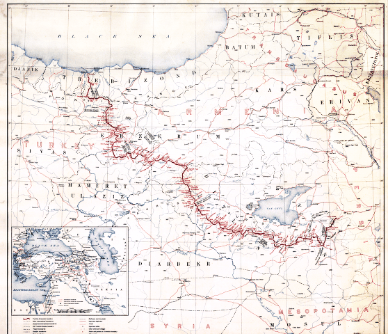
Map showing the boundaries of Armenia as awarded by President Wilson
Wilsonian Armenia
- Date
- 1920
- Mapmaker / publisher
- Published by the United States Government
- Place
- the Treaty of Sèvres
- Archive
- Wikimedia Commons
- Type
- map
- Original size
- 471 × 599 pixels
Public domainsafest
Reason: a US government work.
Read from: Commons licence category: PD US Government; no CC BY, CC BY-SA, GFDL or deletion tag on the file page; permission field: Work by the US Government during the Paris Peace Conference in preparation for the Treaty of Sèvres.
Credit line
"Map showing the boundaries of Armenia as awarded by President Wilson" (1920). Published by the United States Government, via Wikimedia Commons. Public domain. https://commons.wikimedia.org/wiki/File:Map_showing_the_boundaries_of_Armenia_as_awarded_by_President_Wilson.jpgNeed maps for a whole project? Add Find Any Map to Claude and ask for this one by its id: 22950.
More like this

Treaty of Sevres, President Wilson Armenian Boundary 02
July 28, 2012 · Wikimedia Commons

Boundary between Turkey and Armenia as determined by Woodrow Wilson
August 26, 2012 · Wikimedia Commons

Boundary between Turkey and Armenia - as determined by Woodrow Wilson, president of the United States of America
1920 · Library of Congress

Wilsonian Armenia National Geographic 1921
1921 · Wikimedia Commons
First republic of Armenia-west borders by Woodrow Wilson
Wikimedia Commons

Armenia by the Sevres Treaty 1920
September 24, 2011 · Wikimedia Commons

«Armenian Hearth» proposal.Lausanne conference1924
1924 · Wikimedia Commons

Armenia in Paris Peace Conference 1919
1919 · Wikimedia Commons