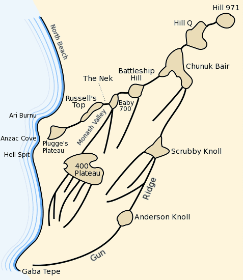

Anzac plateaus and ridges
Map of the Anzac battlefield at:en:Gallipoli depicting the main plateaus and ridges. Traced from marginal map in Ch.11, Vol. I "The Story of Anzac" of the:en:Official History of Australia in the War of 1914-18 by:en:C.E.W. Bean.
- Date
- March 11, 2004
- Archive
- Wikimedia Commons
- Type
- map
- Original size
- 477 × 550 pixels
Public domain
Reason: public domain: user.
This status rests on the map's publication history, as researched by Wikimedia Commons. Check it before commercial use.
Read from: Commons licence category: PD-user; no CC BY, CC BY-SA, GFDL or deletion tag on the file page.
Credit line
"Anzac plateaus and ridges" (March 11, 2004). Wikimedia Commons. Public domain. https://commons.wikimedia.org/wiki/File:Anzac_plateaus_and_ridges.pngNeed maps for a whole project? Add Find Any Map to Claude and ask for this one by its id: 22541.
More like this
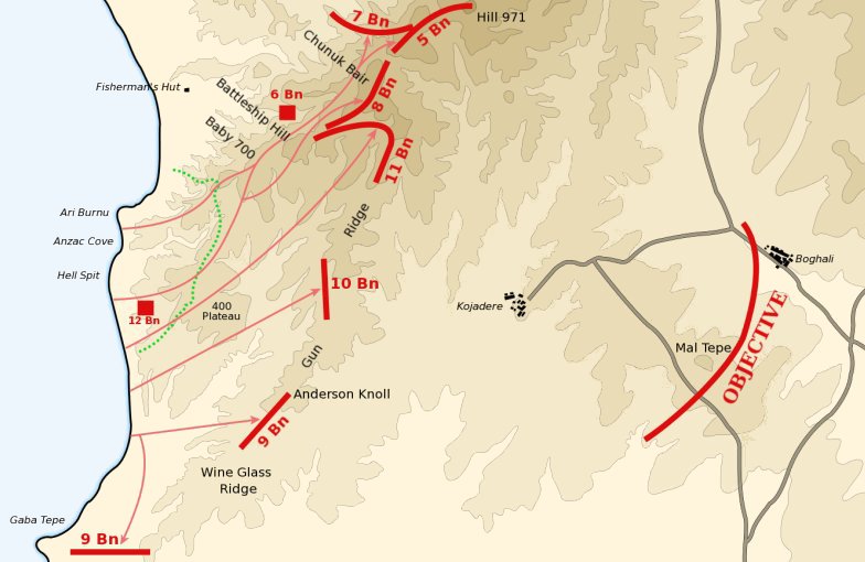
Anzac landing plan April 25 1915
March 13, 2004 · Wikimedia Commons

Map of 400 Plateau Anzac landing
April 18, 2004 · Wikimedia Commons

Anzac Cove region topographic battlefield map H.E.C. Robinson 1916 (georeferenced)
1916–2014 · Wikimedia Commons

Baby 700 afternoon April 25 1915
March 29, 2004 · Wikimedia Commons

Topographic map of Galipoli Peninsula, Turkey, showing ANZAC and Turkish posts, trenches, tracks and roads, and approximate landing places. Area covered from north of Bauchops Hill, to Wine Glass Ridg
1916–2014 · Wikimedia Commons

Anzac covering force landing April 25 1915
c. 2004 · Wikimedia Commons

Anzac Cove landing map used by Raymond Leane
1915 · Wikimedia Commons
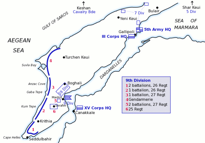
Map of Turkish forces at Gallipoli April 1915
March 12, 2004 · Wikimedia Commons