

Anzac Cove landing map used by Raymond Leane
This map of Gallipoli belonged to Captain (later Brigadier General) Raymond Leane. The map is annotated with Turkish defences and is very fragile. Leane was an officer with the 11th Battalion and used the map at the landing at ANZAC Cove. He landed north off Ari Burnu at 4.55 am. Although kept in reserve for a time, his company eventually fought around Pope’s Hill and Courtney’s Post. On 4 May Leane used this map on a raid of the Turkish positions at Gaba Tepe, where they believed artillery observers were located. They were to note what defences protected the area, destroy communications and destroy any garrisons there. They landed at Gaba Tepe at dawn. As they rushed to the beach they came under intense fire and sought protection from the bank. They could not advance any further and were forced to withdraw.
- Date
- 1915
- Mapmaker / publisher
- Printing Section, General Headquarters, Mediterranean Expeditionary Force
- Archive
- Wikimedia Commons
- Type
- map
- Original size
- 3,632 × 5,262 pixels
Public domain
Reason: public domain: Australia.
This status rests on the map's publication history, as researched by Wikimedia Commons. Check it before commercial use.
Read from: Commons licence category: PD-Australia; no CC BY, CC BY-SA, GFDL or deletion tag on the file page.
Credit line
"Anzac Cove landing map used by Raymond Leane" (1915). Printing Section, General Headquarters, Mediterranean Expeditionary Force, via Wikimedia Commons. Public domain. https://commons.wikimedia.org/wiki/File:Anzac_Cove_landing_map_used_by_Raymond_Leane.jpgNeed maps for a whole project? Add Find Any Map to Claude and ask for this one by its id: 22551.
More like this

Air Reconnaissance Map Gallipoli Peninsula April 1915
1915 · Wikimedia Commons

Battle of the Nek - map of objectives
July 20, 1915 · Wikimedia Commons

Battle of the Nek - map of objectives
Wikimedia Commons

Battle of Gallipoli - Turkish map of Suvla and ANZAC areas
1915 · Wikimedia Commons

Topographic map of Galipoli Peninsula, Turkey, showing ANZAC and Turkish posts, trenches, tracks and roads, and approximate landing places. Area covered from north of Bauchops Hill, to Wine Glass Ridg
1916–2014 · Wikimedia Commons

Anzac Cove region topographic battlefield map H.E.C. Robinson 1916 (georeferenced)
1916–2014 · Wikimedia Commons
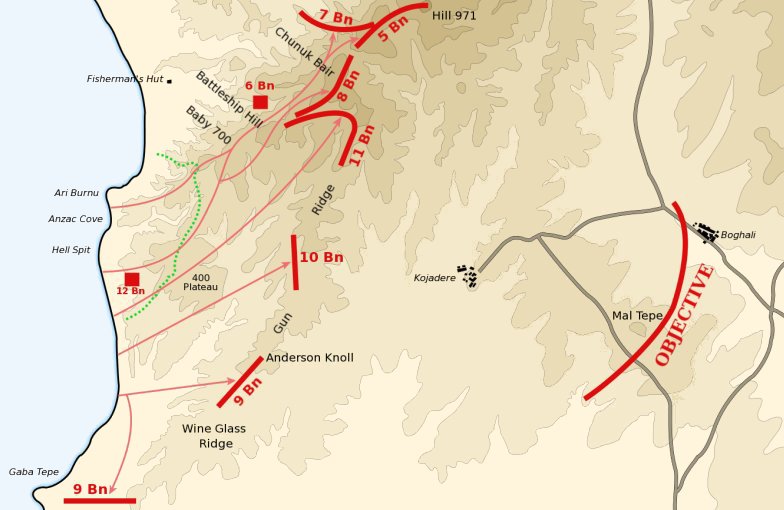
Anzac landing plan April 25 1915
March 13, 2004 · Wikimedia Commons

Map of the ANZAC position, Gallipoli, to illustrate Sir Ian Hamilton's despatch of December 11th, 1915, 1-20,000
1916 · Wikimedia Commons