

A Map of the World
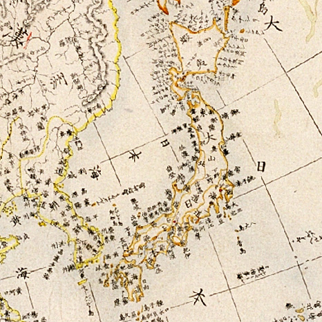
While under nearly two centuries of restricted foreign contact during the Edo period (1600-1868), the Japanese people still maintained a curiosity in foreign cultures. World maps in particular are indications of how the Japanese perceived their country and its position in the international community. Many were published in the port city of Yokohama and popularized for both informational and entertainment purposes. This map, a woodcut dating from the second half of the 19th century, depicts an enormous archipelago representing Japan at the center of the world. Images of a Russian soldier and an American soldier and the brief history of each country are placed in insets. Different kinds of ships dot the seas. The map is also accompanied by a table showing the distance from Nagasaki to various foreign countries, such as China, India, and the Netherlands. On the bottom right are the names of feudal lords who were assigned the duties of guarding the coast. Nautical charts; Ships; Soldiers; Woodcuts
- Date
- 1850–1900
- Archive
- Wikimedia Commons
- Type
- map
- Original size
- 1,347 × 1,024 pixels
Public domainsafest
Reason: its maker died more than 100 years ago, and a faithful scan of a flat work adds no new copyright.
Read from: Commons licence category: PD-Art (PD-old-100); no CC BY, CC BY-SA, GFDL or deletion tag on the file page.
Credit line
"A Map of the World" (1850–1900). Wikimedia Commons. Public domain. https://commons.wikimedia.org/wiki/File:A_Map_of_the_World_WDL6672.pngNeed maps for a whole project? Add Find Any Map to Claude and ask for this one by its id: 144515.
More like this

Shinsei yochi zenzu (ALT: Kaei kotei tozai chikyu bankoku zenzu )
1848 · Wikimedia Commons

World map from Japan, by Takahashi Kageyasu 1816
1816 · Wikimedia Commons

Sekai bankoku Nihon yori kaijō risū ōjō jinbutsuzu.
1800 · Library of Congress

People of Many Nations
1800–1850 · Wikimedia Commons

Japanese map of the world, 1792.
1792 · Wikimedia Commons
Zyutei bankoku zenzu 1855
1855 · Wikimedia Commons

Sekai daisō no zu.
1830 · Library of Congress

World map from Japan, Bankoku sozu, 1671
1671 · Wikimedia Commons