

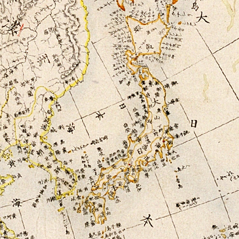
Shinsei yochi zenzu (ALT: Kaei kotei tozai chikyu bankoku zenzu )
An extraordinary Japanese woodblock map of the world dating to 1848 by Shincho Kurihara and Heibe Chojiya. This map, whose title literally translates as Newly Made Map of the Earth represents an important advancement in Japanese globular cartography. As a result of the Sakoku or Chained Country policy enforced in Japan between 1633 and 1853, Japanese cartographers had only the vaguest ideas of what lay beyond their own well mapped borders. What little knowledge available was usually transmitted through Dutch traders in Nagasaki and Chinese merchants who traded with the semi independent Ryukyu Kingdom to the south. Consequently, cartographic conventions common in Europe were slow to penetrate Japan. Until about 1840, most Japanese world maps followed 17th century European maps which tended to show California as an Island and the fictional southern continent of Terre Australis, among other anomalies. This map however, offers a more contemporary perspective generally in line with the most advanced European cartographic knowledge of the period. Here the world is presented in a double hemisphere projection - a style that first appeared in Japan around 1810 - and cartographically is quit
- Date
- 1848
- Archive
- Wikimedia Commons
- Type
- map
- Original size
- 5,000 × 2,925 pixels
Public domainsafest
Reason: its maker died more than 100 years ago.
Read from: Commons licence category: PD-old-100-expired; no CC BY, CC BY-SA, GFDL or deletion tag on the file page.
Credit line
"Shinsei yochi zenzu (ALT: Kaei kotei tozai chikyu bankoku zenzu )" (1848). Wikimedia Commons. Public domain. https://commons.wikimedia.org/wiki/File:1848_Japanese_Map_of_the_World_in_Two_Hemispheres_-_Geographicus_-_World-shincho-1848.jpgNeed maps for a whole project? Add Find Any Map to Claude and ask for this one by its id: 144290.
More like this

Oranda Chikyu Zenzu
1840 · Wikimedia Commons

Shintei - Chikyu Bankoku Hozu (Square Map of all the Countries on the Globe)
1853 · Wikimedia Commons

Nansenbushu Bankoku Shoka No Zu (Outline Map of All Countries of the Universe)
1710 · Wikimedia Commons

World map from Japan, by Takahashi Kageyasu 1816
1816 · Wikimedia Commons

Ca. 1750 Japanes world map - Chiku Bankoku Ichizan no Zu - Comprehensive Image of the World's Myriad Countries
c. 1750 · Wikimedia Commons
Zyutei bankoku zenzu 1855
1855 · Wikimedia Commons

Nansenbushu Bankoku Shoka No Zu (Outline Map of All Countries of the Universe)
1710 · Wikimedia Commons

Sekai bankoku Nihon yori kaijō risū ōjō jinbutsuzu.
1800 · Library of Congress